Light Pollution and the Bortle Scale: How to Find Truly Dark Skies
What the Bortle scale actually measures, how to read a real light pollution map, why deserts and remote islands stay dark, and where the certified Dark Sky Places are if you want to plan a trip around one.
Light Pollution and the Bortle Scale: How to Find Truly Dark Skies
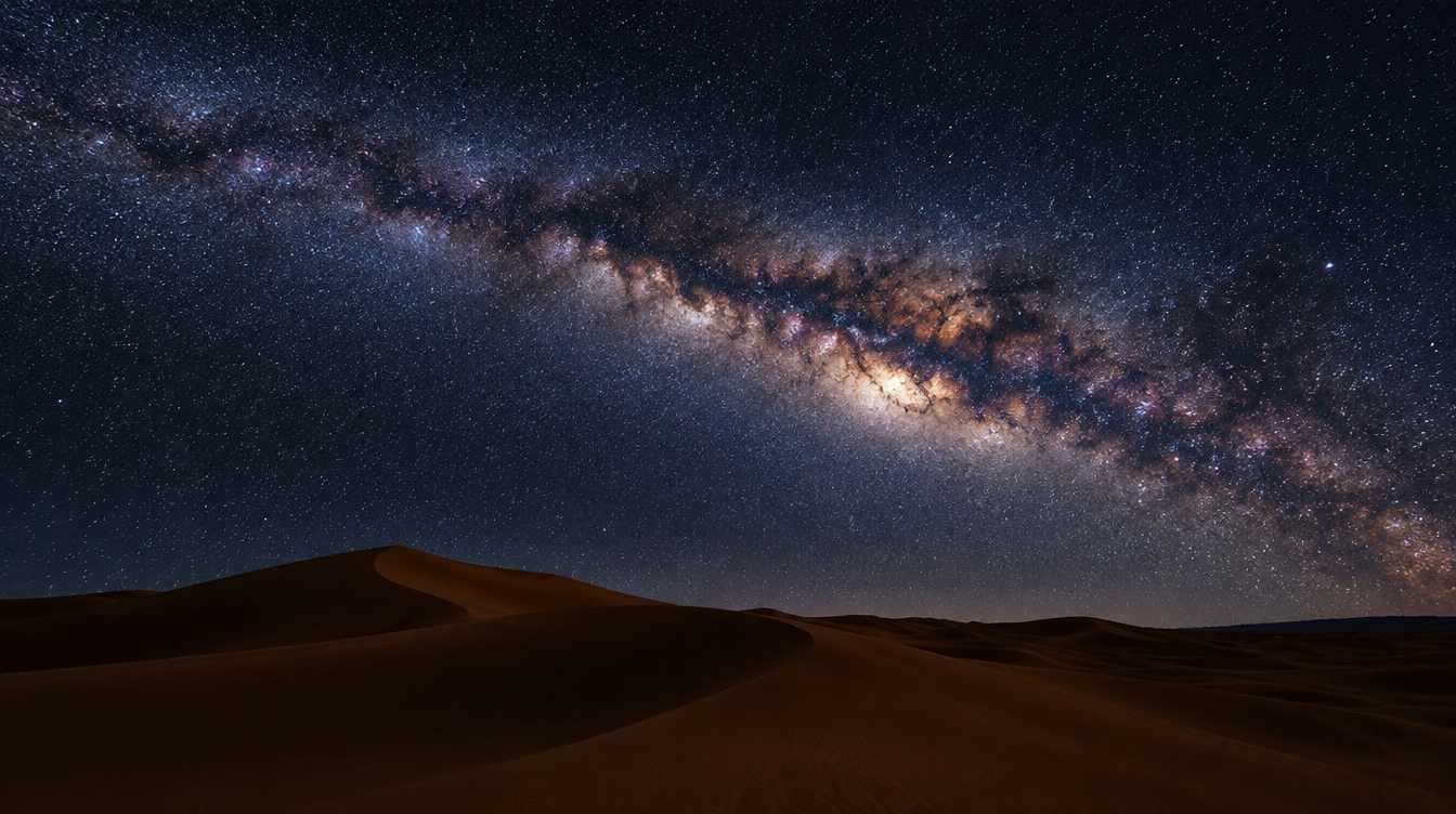
Every trip I have led into genuinely dark places, from a desert camp in the Sahara to a hilltop field in Val d'Orcia at three in the morning, has at least one guest who looks up on the first clear night and says some version of "I didn't know the sky could look like this." Almost nobody has actually seen a dark sky before they travel to find one, because almost nowhere most of us live is dark anymore. That is a measurable fact, and it is the whole reason a scale like Bortle's exists.
The problem with "it looked dark to me" is that it is a useless planning tool. Your backyard at midnight feels dark compared to your living room, but it might still be too bright to resolve the core of the Milky Way. A scouting trip that relies on vibes instead of data is how photographers end up driving two hours out of a city and getting a flat gray frame instead of the galaxy. This guide is the one I wish every guest read before booking a night shoot: what the Bortle scale actually measures, how to read a real light pollution map instead of guessing, why deserts and remote islands stay dark when almost everywhere else is brightening, and where the genuinely certified dark places are if you want to plan a trip around one.
Key Takeaways
The Bortle scale is a useful shorthand, not a precise instrument, and pairing it with an actual light pollution map changes how you plan a night shoot.
| Point | Details |
|---|---|
| What the Bortle scale measures | A 9-class visual rating of night sky brightness, created by John Bortle and published in Sky & Telescope in February 2001 |
| The practical Milky Way benchmark | Bortle Class 4 or better for the galactic core to show at all; Class 1 to 3 for real structure and photographic detail |
| Its honest limitation | It is a subjective, naked-eye scale, not a fixed instrument reading, and researchers have flagged that Bortle likely overestimated what typical observers can see |
| Why deserts and islands stay dark | Skyglow comes from nearby artificial light scattering off the atmosphere; low population density means there is nothing close enough to scatter |
| The trend | Global night sky radiance rose 34 percent between 2014 and 2022, according to NASA's Black Marble satellite data, though some regions are dimming |
| Where to plan a trip | DarkSky International's certified Dark Sky Places, including Natural Bridges National Monument (the first ever certified, in 2007) and Death Valley National Park |
Table of Contents
- What the Bortle scale actually measures
- How dark is dark enough for the Milky Way
- How to actually read a light pollution map
- Why deserts and remote islands are so dark
- Certified Dark Sky Places worth planning a trip around
- The measurable problem: light pollution is getting worse
- Planning your own dark sky trip: a checklist
- Frequently asked questions about light pollution and the Bortle scale
What the Bortle scale actually measures
The Bortle scale was created by an amateur astronomer named John E. Bortle, who published it in Sky & Telescope magazine in February 2001 as a way to describe, in nine numbered classes, how badly a given location's night sky is washed out by artificial light. It runs from Class 1, the darkest skies left on Earth, to Class 9, the solid orange glow over a city center, and it is still the single most commonly cited shorthand in the astrophotography world, including by me, when a guest asks how dark a location actually is before we drive out to shoot it (Wikipedia's Bortle scale entry).
At the extremes, the scale is easy to describe in plain language rather than numbers. A true Class 1 site is dark enough that the Scorpius and Sagittarius regions of the Milky Way cast faint shadows on the ground, a sensation almost nobody who has not traveled for it has experienced. A Class 8 sky, the kind most of us live under, looks light gray or orange even well after sunset, the kind of sky bright enough to read a book by without a flashlight. Everything in between is a sliding scale of how much of that fainter detail survives (Bortle scale, Wikipedia).
| Bortle Class | What you would actually see | Sky brightness (SQM, mag/arcsec²) |
|---|---|---|
| Class 1 (excellent dark-sky site) | The Milky Way core casts visible ground shadows; the Scorpius and Sagittarius regions show obvious structure | 21.76 to 22.0 and darker |
| Classes 2 and 3 (typical truly dark site) | Still a rich, detailed Milky Way and a sky that feels genuinely rural, just a notch below the very best wilderness sites | Darker end of the rural range, between Class 1 and the Class 4 benchmark below |
| Class 4 (rural or suburban transition, the Milky Way benchmark) | The Milky Way is still impressive well above the horizon but lacks fine detail; roughly the point where the galaxy M33 becomes a fair naked-eye test | 20.8 to 21.3 |
| Classes 5 through 7 (bright suburban to city outskirts) | The Milky Way fades to a faint smudge at best, then disappears entirely as you move toward Class 7 | Steadily brighter than Class 4, below the rural range |
| Class 8 (city sky) | The sky itself looks light gray or orange; easily bright enough to read by | Below 18.00 |
| Class 9 (inner-city sky) | Only the Moon, planets, and the brightest star clusters are visible at all | Brighter than Class 8 |
What the scale does not do is give you a precise physical measurement. It is a visual, subjective rating based on what a human eye reports seeing on a given night, not a fixed instrument reading, and a 2014 study actually suggested that Bortle overestimated how easily a typical observer can pick out faint, diffuse objects even under genuinely dark skies (Bortle scale, Wikipedia). Treat it as a fast shorthand for a conversation, not a lab result. If you want a number you can measure and compare between two sites, that is what a Sky Quality Meter reading, expressed in magnitudes per square arcsecond, is for, and it is exactly what the next section's map tool gives you for free.
Pro Tip: When a guest asks me "how dark is Class 1, really," I tell them to try the moon shadow test. If you can see your own shadow cast by nothing but the Milky Way on a moonless night, you are standing somewhere close to Class 1. Almost nobody gets to try this at home.
How dark is dark enough for the Milky Way
This is the question that actually matters when you are planning a trip rather than reading trivia. The practical benchmark most working astrophotographers use, including the one built into the Bortle scale's own documentation, is that you need Class 4 or better for the galactic core to show up as a recognizable band at all, and Class 1 through 3 if you want the kind of structure, dust lanes, and contrast that make a Milky Way photograph actually sing (Bortle scale, Wikipedia). Below Class 4, you can still record stars, but the galaxy itself starts disappearing into the background glow faster than any editing can rescue.
Darkness alone will not save a shoot if you get the other two variables wrong. Moon phase matters just as much as location, since even a half moon adds enough skyglow of its own to wash out the same faint detail a dark site is supposed to protect, and galactic core season is a real calendar constraint, since the core is only well positioned above the horizon for part of the year depending on your latitude. I cover both variables, along with the camera settings that actually make a dark site pay off, in our full Milky Way field guide, so I will not repeat the settings breakdown here. For a quick gut check on how long an exposure your lens and camera combination can handle before stars start trailing, our piece on the 500 rule versus the NPF rule is the companion piece worth reading before you travel.
How to actually read a light pollution map
Almost every astrophotography article tells you to "check a light pollution map" and then stops there. That advice is useless if you do not know what you are looking at, so here is the walkthrough I actually give guests before a trip. The tool I use, and the one most of the community relies on, is lightpollutionmap.info. It layers several different satellite and model datasets on top of a standard map, including a VIIRS annual satellite layer, a VIIRS trend layer that shows whether a region is brightening or dimming over time, and a World Atlas 2015 layer built from an earlier, widely cited global model (lightpollutionmap.info).
The color gradient you see, running from deep blue and black through green, yellow, orange, and finally red, is not decoration. It is a visual encoding of the same kind of brightness unit astronomers use in the field, expressed as magnitudes per square arcsecond, where a higher number is darker sky and a lower number is a brighter, more polluted one. You can click or hover anywhere on the map to get a reading for that exact point, use the site's area and point query tools to compare two candidate locations side by side, and use its "find closest dark site" feature if you are starting from a city and just need the nearest genuinely usable sky (lightpollutionmap.info).
Here is the part most guides skip entirely: do not just look at the color under your own pin. Look at how far the nearest orange or red glow dome extends outward from the city or town causing it. A location that reads dark blue on the map but sits twelve miles from a mid sized town can still have a visible glow low on one horizon, which will not ruin your zenith shots but will show up if you frame a foreground toward that direction. The map tells you about the sky overhead; your own judgment about where you point the camera tells you the rest.
Why deserts and remote islands are so dark
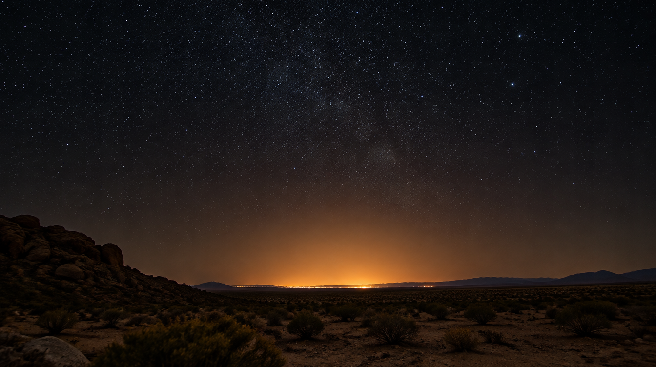
Travel articles love to describe deserts as having "dark skies free of light pollution," which is true but almost never explained. The mechanism is simpler than it sounds. The glow over any city at night is not light traveling up into space, it is light scattering off molecules and particles in the atmosphere and bouncing back down, and the brightness of that scatter depends on how much artificial light exists nearby, not simply on distance from the largest city on the map. Satellite nighttime-lights imagery, which captures only artificial light, consistently shows the brightest concentrations directly over dense population centers, especially near coastlines and fresh water, and essentially nothing over places with no people in them (NOAA Science On a Sphere, Blue Marble and Nighttime Lights).
A desert interior is dark for exactly this reason: there is nothing nearby to scatter. Low population density means no streetlights, no parking lots, no stadium floodlights within scattering range, so the atmosphere above a remote desert camp has almost nothing artificial to reflect back down. The same mechanism, at a different scale, makes a remote island dark, or the interior of a national park dark compared to its own entrance road. It is proximity to light sources that matters, not raw distance from the nearest major city.
This is also the exact reason the Sahara is one of the destinations I keep coming back to for night photography. On our Tunisia Milky Way Phototour, we base out of Tozeur and then take a long 4x4 drive deep into the dunes to a dedicated desert camp, far past the last settlement, specifically so the two Milky Way nights built into the itinerary have nothing between the camera and the galaxy but sand and silence. Our guide for that trip, Lorenzo Ranieri Tenti, a two-time Milky Way Photographer of the Year award winner, builds the whole week around those two dedicated night sessions, and the itinerary includes a post-processing course so you know what to do with the files once you are home. If reading a map and hoping you found a dark enough spot sounds like more effort than you want to put in, this is the version where someone else has already done that work for you.
Certified Dark Sky Places worth planning a trip around
If you would rather not rely on reading a map yourself at all, there is an entire certification system built for exactly this. DarkSky International runs an International Dark Sky Places program with five categories, Sanctuaries, Parks, Reserves, Communities, and Urban Night Sky Places, each with its own requirements around outdoor lighting quality and ongoing stewardship, not just a one time measurement (Dark-sky preserve, Wikipedia). As of a January 2023 count, there were 201 certified Dark Sky Places globally, a mix of 38 Communities, 115 Parks, 20 Reserves, 16 Sanctuaries, and 6 Urban Night Sky Places, and the program has grown since, so treat any specific number you read as a floor, not a ceiling (Dark-sky preserve, Wikipedia).
Two US national parks are worth knowing by name if you want a credible starting point rather than a random pin on a map. Natural Bridges National Monument in Utah became the first International Dark Sky Park ever certified anywhere, on March 6, 2007 (National Park Service, Natural Bridges). Death Valley National Park followed in February 2013, described at the time as the third International Dark Sky Park in the US National Park System and the largest (National Park Service, Death Valley). Both sit under the Park Service's broader Night Skies program, which protects natural night skies and nocturnal environments across the park system under the agency's own Organic Act mandate, treating dark skies as an ecological, cultural, and wilderness character resource, not just a nice view (National Park Service, Night Skies program).
Pro Tip: A certified Dark Sky Place is a trustworthy starting point precisely because someone measured it and keeps the lighting around it managed. A spot you found on a map that reads dark blue today can get a new gas station and a floodlit parking lot within a few years. A certified site has a stewardship commitment behind it.
The measurable problem: light pollution is getting worse
This is not a static situation you can plan around once and forget. NASA's Black Marble nighttime-lights product, built from satellite sensors that image the planet after dark, found that global artificial light radiance increased by 34 percent between 2014 and 2022 (NASA Science, Picturing Earth in a New Light). That headline number hides a mixed picture region by region. France's measured radiance dropped 33 percent over the same period, the UK by 22 percent, and the Netherlands by 21 percent, credited partly to LED adoption and partly to the 2022 European energy crisis pushing cities to dim non-essential lighting. China, northern India, and cities along the US West Coast brightened considerably over the same window (NASA Science, Picturing Earth in a New Light).
The practical takeaway for anyone planning photography trips, not writing a dissertation, is this: a dark site you shot five years ago is not guaranteed to still be dark today, and a genuinely remote site, the kind with nothing nearby to brighten in the first place, becomes more valuable over time, not less. That is the argument for building a trip around a place like the Sahara interior instead of a forty minute drive outside your own city. The forty minute drive keeps getting worse. The desert does not.
Planning your own dark sky trip: a checklist
Here is the same checklist I run through with guests before any night shoot, whether it is a single evening or the two dedicated Milky Way nights built into a full tour itinerary.
| Check | Why it matters |
|---|---|
| Pull up lightpollutionmap.info for the actual location, not a nearby town | A map reading twelve miles away can be a full Bortle class or more different from your real shooting position |
| Check for a certified Dark Sky Place if you want a guaranteed result | Certification means managed lighting and ongoing stewardship, not just a one time reading |
| Check moon phase for your shooting dates | A bright moon adds its own skyglow on top of whatever light pollution already exists |
| Confirm galactic core season for your latitude if shooting the Milky Way | The core is only usefully positioned above the horizon part of the year |
| Bring a red headlamp, not your phone screen | Preserves everyone's night vision and keeps you from ruining a group's long exposures |
| Scout your composition in daylight the day before | Finding your footing and framing in full dark, for the first time, wastes shooting time and is a real safety risk on uneven ground |
Frequently asked questions about light pollution and the Bortle scale
What is the Bortle scale? It is a nine class scale, from Class 1 (the darkest skies on Earth) to Class 9 (inner city skies), created by amateur astronomer John Bortle and published in Sky & Telescope in February 2001 to describe how much a location's night sky is affected by light pollution, based on what is visible to the naked eye.
How dark does the sky need to be to see the Milky Way? Bortle Class 4 or better for the galactic core to be visible as a recognizable band at all. Class 1 through 3 gets you the structure, dust lanes, and contrast that make a photograph genuinely impressive rather than just technically visible.
Can you see the Milky Way from a city? No, not with the naked eye. City skies sit at Class 7 through 9 on the scale, bright enough that only the Moon, planets, and the brightest star clusters survive the glow.
Why are deserts and islands so good for stargazing? Skyglow comes from artificial light scattering off the atmosphere, and that scatter depends on how much artificial light exists nearby, not simply on distance from the nearest major city. Low population density means there is nothing close enough to scatter, which is why remote deserts and islands stay dark while plenty of rural land closer to a mid sized town does not.
What is the difference between a Dark Sky Park, Reserve, Sanctuary, and Community? They are the five certification categories in DarkSky International's program, covering everything from a protected wilderness core (Sanctuaries and Parks) to inhabited areas with responsible lighting ordinances (Communities), down to a single well managed urban park (Urban Night Sky Places). The category tells you how much of the surrounding area is protected, not just the reading at one point.
Is light pollution actually getting worse? Globally, yes. NASA's satellite data shows a 34 percent increase in measured night sky radiance between 2014 and 2022, though the trend is uneven, with some regions, including parts of Western Europe, measurably dimming over the same period thanks largely to LED adoption.
How do I measure sky darkness myself, without a map? A handheld Sky Quality Meter gives an objective reading in magnitudes per square arcsecond, the same unit lightpollutionmap.info uses. Without one, a rough proxy is checking how many stars you can resolve in a familiar constellation's faintest members, though that is exactly the kind of subjective test the Bortle scale itself is built on.
Once you have found a site dark enough to be worth the trip, the gap between a technically dark sky and a genuinely strong photograph is almost entirely about settings, framing, and timing. Our Milky Way field guide and our guide to photographing the northern lights both pick up exactly where this one leaves off, once you already know the sky above you is actually dark enough to work with. For the full picture of how night photography fits alongside everything else in landscape work, our Landscape Photography Guide is the pillar page that ties it all together.
Sources
- Bortle scale: Wikipedia entry on the nine-class scale, its origin, and its known limitations
- National Park Service: Natural Bridges National Monument, the first certified International Dark Sky Park
- National Park Service: Death Valley National Park's 2013 International Dark Sky Park designation
- National Park Service: Night Skies program overview
- NASA Science: Picturing Earth in a New Light, on global night-sky radiance trends
- NOAA Science On a Sphere: Blue Marble and Nighttime Lights dataset
- lightpollutionmap.info: interactive light pollution mapping tool
- Dark-sky preserve: Wikipedia entry on DarkSky International's certification categories