The Snæfellsnes Peninsula: Iceland in Miniature for Photographers
Why the Snæfellsnes Peninsula packs a glacier volcano, lava fields, basalt sea cliffs, and Kirkjufell into one drivable loop, and how to shoot all of it in a single winter day.
The Snæfellsnes Peninsula: Iceland in Miniature for Photographers
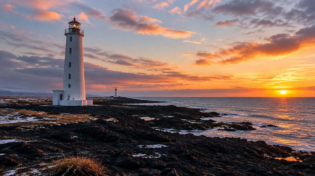
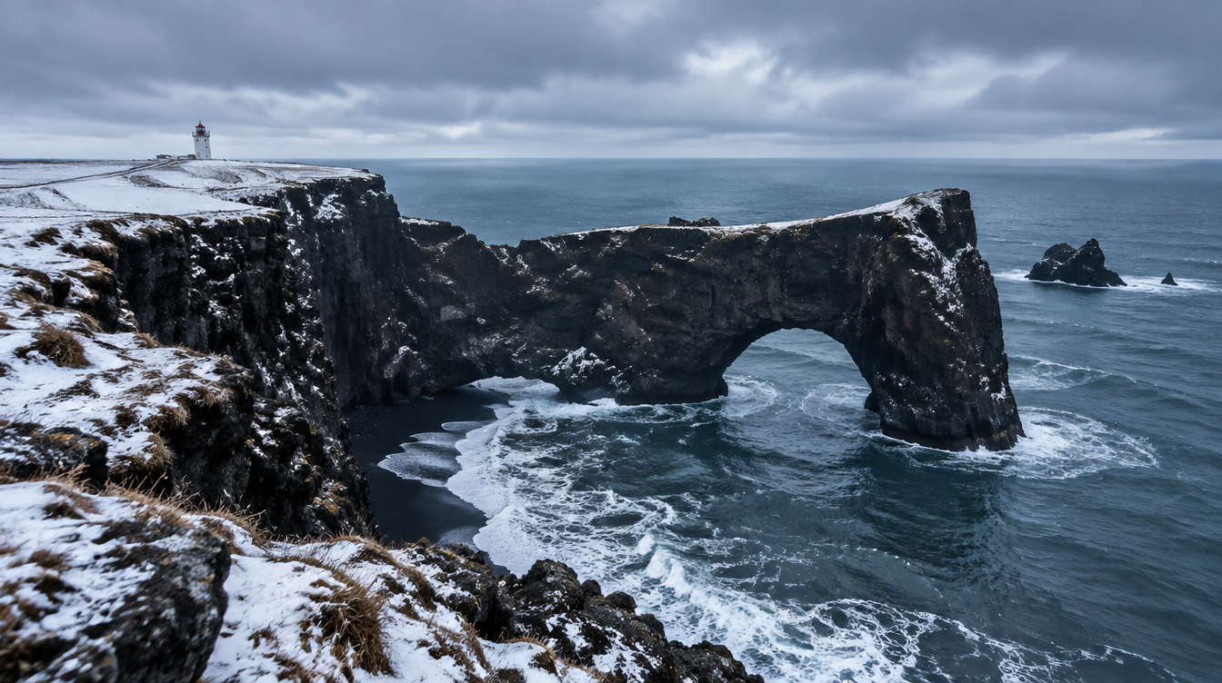
There is a running joke among the guides I work with in Iceland that if a client only has one extra day before their flight home, you send them to Snæfellsnes rather than back out on the Golden Circle for a second lap. The peninsula earns the nickname "Iceland in miniature" for a simple reason: in roughly ninety miles of coastal road you drive past a glacier-capped volcano, black lava fields, a national park, sheer basalt sea cliffs, a pair of freestanding rock towers, and one of the most photographed mountains on earth. No other single day trip from Reykjavík packs in that much landscape variety.
This guide is built around one specific day, the way we actually run it on our own Iceland Winter Aurora tour, and the way I would plan it myself if I only had the daylight hours of a single winter day to work with. It is not a sightseeing checklist. It is a shooting order, built around where the light falls best at each stop, plus the honest winter logistics that most articles about this peninsula skip entirely because they were written from a July road trip.
Key Takeaways
Snæfellsnes rewards photographers who plan the day around light and daylight hours rather than treating it as a box to check off a list.
| Point | Details |
|---|---|
| Why it is called "Iceland in miniature" | A single peninsula with a glacier volcano, lava fields, a national park, sea cliffs, and basalt towers, all within one drivable loop |
| Distance from Reykjavík | Roughly 90 to 95 miles one way via Route 1 and Route 54, around two hours of driving without stops |
| Winter daylight reality | As little as about 4 hours around the December solstice in this part of Iceland, against roughly 21 hours at the June solstice |
| Best single shooting order | Arnarstapi and Hellnar in flat or early light, Londrangar at midday to early afternoon, Kirkjufell saved for golden hour and blue hour |
| Snæfellsjökull glacier | A roughly 700,000 year old stratovolcano whose ice cap has shrunk from about 16 square kilometers in 1946 to around 10 to 11 in 2008 |
| Status | The area around Snæfellsjökull is one of Iceland's four national parks, and the wider peninsula was designated a UNESCO biosphere reserve in 2025 |
Table of Contents
- Why Snæfellsnes earns the nickname "Iceland in miniature"
- Getting there and getting oriented
- Arnarstapi and Hellnar: the basalt coastline
- Londrangar: the basalt pillars
- Kirkjufell: the icon at the end of the day
- Snæfellsjökull and the lava fields
- Winter logistics: daylight, weather, and roads
- Is Snæfellsnes worth it compared to the Golden Circle?
- Frequently asked questions about photographing Snæfellsnes
- Plan your own Snæfellsnes day
Why Snæfellsnes earns the nickname "Iceland in miniature"
Snæfellsnes sits on the west coast of Iceland, a long finger of land reaching out into the North Atlantic west of Borgarfjörður, and it is built on its own volcanic belt that runs straight down the middle of the peninsula. That geology is exactly what makes it such a compressed sampler of the country. Drive the loop road and you pass through old lava fields that look almost lunar in flat light, past fishing villages tucked into fjords, along a coastline carved into arches and sea stacks, and underneath a glacier that has been visible from Reykjavík on clear days for as long as anyone has kept records.
The towns and villages along the way, places like Arnarstapi, Hellnar, Rif, Ólafsvík, Grundarfjörður, and Stykkishólmur, are small enough that you can shoot through most of them in minutes rather than hours, which is part of why the peninsula compresses so well into a single day. You are never driving more than twenty or thirty minutes between one completely different landscape type and the next. I have had clients ask, genuinely, whether we drove through three or four separate regions of the country in one afternoon. We did not. That is just what Snæfellsnes does to a camera bag full of different lenses.
If you want the fuller context on how this fits into an Icelandic winter trip overall, including how Snæfellsnes compares to the other locations we shoot, our Iceland Winter Photography guide is the pillar piece this article sits under.
Getting there and getting oriented
From Reykjavík, you take Route 1 north out of the city and then branch onto Route 54, which runs the length of the peninsula. The drive to the far end, where Arnarstapi and Snæfellsjökull National Park sit, covers roughly 90 to 95 miles one way, which works out to about two hours of actual driving time without stops. Add in photography stops, a lunch break, and the slower pace that ice and snow demand in winter, and a full loop touching the stops in this guide is a comfortable but genuinely full day, leaving Reykjavík well before sunrise and returning well after dark.
The shooting order matters more here than on a typical day trip, because the light does not wait for you. I sequence the day so that the coastal cliffs at Arnarstapi and Hellnar, which photograph well in flatter, more diffuse light, come first. Londrangar, which benefits from side light raking across the basalt towers, comes around midday to early afternoon. Kirkjufell, the most photogenic subject of the day and the one every client wants to end on, gets saved for the last useful light: golden hour, and in winter, the blue hour and aurora window that follows it.
Pro Tip: Fill your tank before you leave the Ring Road. Fuel stations thin out fast once you are past Ólafsvík, and in winter you do not want to be making decisions about range with the heat running and the temperature dropping.
Arnarstapi and Hellnar: the basalt coastline
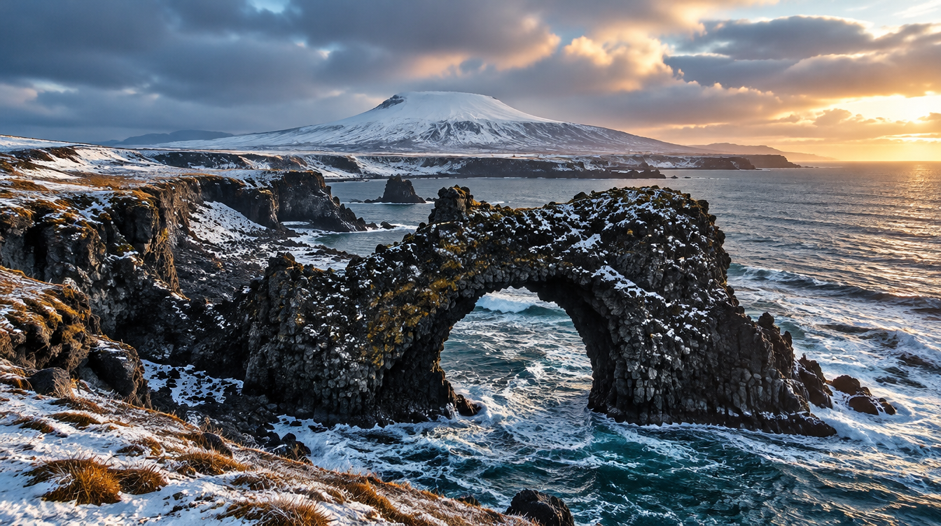
Arnarstapi and Hellnar are two small coastal settlements connected by a walking path along the top of a basalt sea cliff, and together they are the first real photography stop of the day. Arnarstapi's signature feature is Gatklettur, a rock arch standing just offshore that has become one of the more recognizable single frames from this stretch of coast. The cliffs themselves are columnar basalt, the same hexagonal rock structure you see at places like Reynisfjara on the south coast, except here it is folded, twisted, and arched by the sea into shapes that change completely depending on where you stand.
Walk the coastal path toward Hellnar rather than shooting everything from the main Arnarstapi parking area. The rock texture changes noticeably along the way, and Hellnar's own small cove and sea cave give you a quieter, less photographed version of the same coastline. A wide angle lens, something in the 16 to 24mm range on a full frame body, handles most of the arch and cliff compositions well, but keep a mid-range zoom in the bag for isolating individual rock formations and the birds that nest in the cliffs during the warmer months.
In winter this stretch of coast takes on a different character entirely. The grass goes dormant, the light stays low and raking for most of the short day, and the crowds that fill the Arnarstapi parking area in July are simply not there. You get the cliffs closer to yourself, and the low winter sun angle does genuinely flattering things to the texture in the basalt that a high midsummer sun washes out.
Londrangar: the basalt pillars
A short drive past Arnarstapi brings you to Londrangar, two freestanding volcanic rock towers rising out of an old lava field right at the edge of the sea. They are the eroded remnants of a volcanic crater, what is left after the softer surrounding rock wore away and the harder basalt core stayed standing. There is a small viewpoint and a short walking path, and the towers themselves are large enough that you do not need to get dangerously close to the cliff edge to fill a frame with them.
This is the stop where I most often reach for a wide angle lens again, this time to include the lava field in the foreground leading the eye to the towers, with the ocean and, on a clear day, the white dome of Snæfellsjökull in the background. Side light works best here, which is exactly why it fits into the middle of the day on this particular loop: by the time you arrive from Arnarstapi, the sun has usually swung around enough to rake across the pillars rather than sit flat behind your shoulder.
| Stop | Best light for this spot | What to shoot |
|---|---|---|
| Arnarstapi and Hellnar | Flat or low morning light, overcast works well too | Gatklettur arch, cliff texture along the coastal path, Hellnar cove |
| Londrangar | Side light, midday to early afternoon | The two basalt towers with the lava field as foreground, glacier in the background on clear days |
| Snæfellsjökull and the lava fields | Clear days, any time, best at distance in low sun | The glacier dome from a distance, lava field textures close up |
| Kirkjufell | Golden hour through blue hour | The mountain with Kirkjufellsfoss, reflections, and aurora when conditions allow |
Kirkjufell: the icon at the end of the day
Kirkjufell sits further along the peninsula near Grundarfjörður and is, without much competition, the most photographed mountain in Iceland. It earns the last slot in the day for a practical reason as much as an aesthetic one: it is the farthest point on this itinerary, and its best light, the warm wrap of golden hour and the long blue hour that follows it, happens to line up with when you will naturally arrive if you started the day at Arnarstapi.
I am going to keep this section short on purpose. Kirkjufell deserves, and already has, its own dedicated breakdown of composition, the classic waterfall foreground shot, and the quieter angles from the Grundarfjörður side that most visitors never try. If you want the full technique rundown, read our Kirkjufell photography guide. For this article, the point is simpler: treat it as the closing stop of your Snæfellsnes day, not the whole reason for the trip, and you will come home with a much more varied set of images than if you drove straight there and back.
Snæfellsjökull and the lava fields
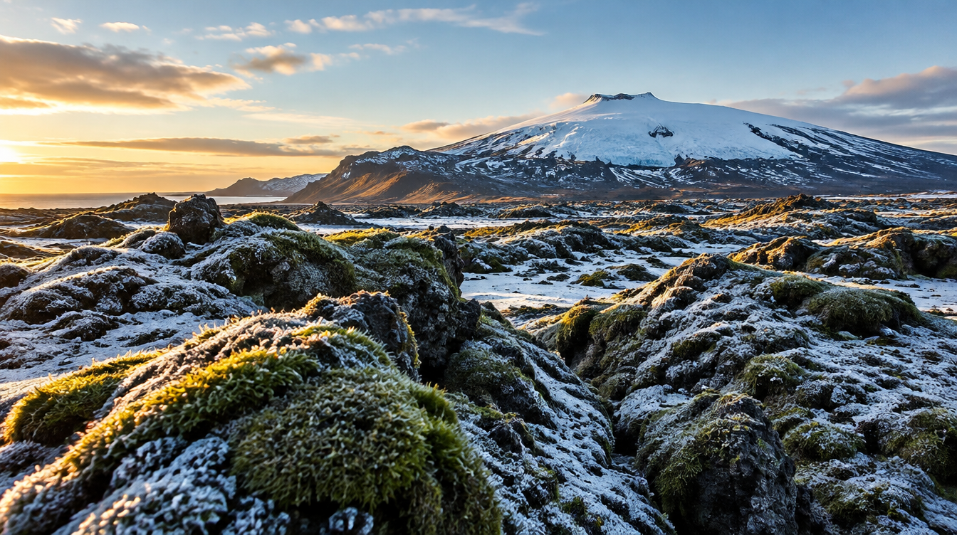
The glacier that gives the peninsula its name sits at the far western tip, a glacier-capped stratovolcano roughly 700,000 years old, with its last known eruption dated to around 200 CE. At 1,446 meters, or about 4,744 feet, it is tall enough that on a clear day you can see it from Reykjavík across Faxaflói bay, roughly 120 kilometers or 75 miles away, which gives you a sense of just how dominant it is over this part of the coastline once you are actually standing underneath it.
It is also a volcano in visible retreat. Its ice cap covered around 16 square kilometers in 1946, shrank to about 14 by 1999, and was down to roughly 10 to 11 square kilometers by 2008. In August 2012 the summit was recorded ice-free for the first time in recorded history. Photographing it today, however dramatic it still looks from a distance, is photographing a glacier that is measurably smaller than it was for most of the twentieth century.
The mountain has a literary claim to fame too. Jules Verne used Snæfellsjökull as the fictional entrance to the center of the earth in his 1864 novel, and the area around it is now protected as one of Iceland's four national parks. In 2025, the wider Snæfellsnes peninsula was designated a UNESCO biosphere reserve, formal recognition of a landscape that was already drawing photographers long before the designation existed.
The lava fields that surround the base of the volcano are worth their own stop regardless of whether the glacier is visible that day. Low winter sun raking across frozen moss-covered lava creates a texture that is almost impossible to get right in flat midday light, and a macro or mid-range lens pulling in close on individual lava formations gives you a completely different kind of image than the wide landscape shots that dominate the rest of the day.
Pro Tip: Do not assume the glacier will be visible just because the forecast looks clear from Reykjavík. Snæfellsjökull generates its own weather systems and is notorious for sitting under cloud even on days that are bright everywhere else on the peninsula. Build in a second viewpoint from further along the loop as a backup rather than planning around a single shot of the summit.
Winter logistics: daylight, weather, and roads
Everything above assumes you have enough daylight to actually run this sequence, and in winter that assumption needs checking before you leave. Around the December solstice, Reykjavík sees sunrise near 11:22am and sunset around 3:29pm, which works out to a little over four hours of daylight. Compare that to the June solstice, when the sun rises before 3am and does not set until just after midnight, roughly twenty-one hours of daylight, and you can see why the same itinerary that feels relaxed in summer becomes a tightly timed operation in winter. By mid November, daylight is already down to around six and a half hours, so even a shoulder season trip compresses this day more than most people expect.
That short window is not purely a limitation. It means golden hour and blue hour, the light that makes Kirkjufell and the Arnarstapi cliffs actually sing, stretch out for a much larger share of your available daylight than they would in summer, when the sun is high and harsh for most of the middle of the day. If you want to understand why this far north the warm, low light lingers so much longer relative to the rest of the day, our guide to mastering golden hour photography in Iceland breaks down exactly why that happens.
The trade-off is road conditions. Route 54 along the peninsula is exposed coastal road, and winter weather in Iceland changes fast enough that a clear morning does not guarantee a clear afternoon. The Icelandic Meteorological Office runs a nightly aurora forecast on a 0 to 9 scale and is explicit that useful aurora viewing requires dark skies and at least partly clear conditions, which is a reasonable proxy for whether the wider weather picture is cooperating that night as well. Checking that forecast before committing to a late stop at Kirkjufell is a habit worth building into every winter evening on this peninsula, not just the nights you are specifically chasing aurora.
This is honestly the single biggest reason we run Snæfellsnes as a guided day rather than leaving clients to a rental car and a printed map. Our Iceland Winter Aurora tour runs this exact route as its second day: sea arches at Arnarstapi, the basalt cliffs at Hellnar, the twin towers at Londrangar, and a finish at Kirkjufell timed for sunset and, when conditions line up, the aurora. The seven day, seven night trip includes ground transportation and airport transfers for the whole itinerary, so the decision of whether that day's weather supports a late stop at Kirkjufell is made by a guide who has driven this road through a dozen winters, not by someone jet lagged and reading a forecast app for the first time. Current departures run around $4,500 per person with a 30 percent deposit, in a small group capped at ten people with one professional photographer guide, plus image review sessions and a post-processing workshop built into the week.
Is Snæfellsnes worth it compared to the Golden Circle?
This is the question I get asked most often by people planning their own trip, usually because they have limited days and have already heard they should do the Golden Circle. The honest answer is that they are not really competing for the same slot. The Golden Circle is shorter, busier, and built around three specific, genuinely excellent sights close to Reykjavík. Snæfellsnes is a longer day, a quieter experience, and a wider variety of landscape types strung along one road, which is exactly the "miniature Iceland" pitch.
If you have one day in Iceland and have never seen a geyser or a waterfall before, the Golden Circle is the more efficient introduction. If you have already done that, or you are specifically there to photograph rather than sightsee, and you can spare a longer day, Snæfellsnes rewards the extra driving with far less crowding at every stop and a sequence of subjects, coastline, lava field, glacier, and iconic mountain, that no Golden Circle itinerary can match in variety. We treat it as the second stop on a week-long trip rather than a rushed half-measure, which is the only way I would personally choose to shoot it.
Frequently asked questions about photographing Snæfellsnes
How long should you spend on the Snæfellsnes Peninsula? A full day covers the core photography stops in this guide comfortably. Two days lets you add quieter extras like Djúpalónssandur's black pebble beach or the town of Stykkishólmur without rushing any one location.
Is Snæfellsnes worth it compared to the Golden Circle? They serve different purposes. The Golden Circle is faster and more iconic but far more crowded. Snæfellsnes trades a longer drive for quieter compositions and far more landscape variety packed into one loop.
What is the best time of year to photograph Snæfellsnes? Summer gives you long light and easier roads. Winter gives you aurora chances, snow-dusted lava fields, and a long golden hour, at the cost of a much shorter daylight window and more variable roads.
Is it safe to self-drive Snæfellsnes in winter? It can be done, but the coastal roads are exposed and weather can shift quickly. This is precisely the kind of day where a guide who already knows the road through winter conditions removes a real risk rather than just adding convenience.
How far is Snæfellsnes from Reykjavík? Roughly 90 to 95 miles to the far end of the peninsula, around two hours of driving one way via Route 1 and Route 54, before accounting for stops.
What is the difference between Arnarstapi and Hellnar? They are two small coastal villages connected by a cliff-top walking path. Arnarstapi has the Gatklettur arch, while Hellnar's cove and sea cave offer a quieter, less photographed version of the same basalt coastline.
Is Kirkjufell on the Snæfellsnes Peninsula? Yes, near the town of Grundarfjörður. It is the peninsula's best known subject, but on this itinerary it is the closing stop of the day rather than the only reason to make the drive.
Plan your own Snæfellsnes day
Snæfellsnes is one of the few places in Iceland where a single day of driving genuinely changes what kind of photographer you come home as, simply because of how much landscape variety is packed into that one loop road. Plan it around the light rather than a sightseeing checklist, respect how little daylight winter actually gives you, and you will come home with a stronger, more varied set of images than almost any other single day trip in the country produces.
If you would rather let someone who has driven this road through a dozen winters handle the timing, weather calls, and the long drive itself, our Iceland Winter Aurora tour runs this peninsula as part of a full seven day, seven night itinerary that also covers the south coast's waterfalls and glacier lagoons. Our Seljalandsfoss and Skógafoss guide covers the other side of that itinerary if you want to see the fuller picture of what a week in Iceland with us actually looks like.
Sources
- Snæfellsnes: Wikipedia entry on geography, towns, national park status, and 2025 UNESCO biosphere designation
- Snæfellsjökull: Wikipedia entry on the volcano's elevation, age, eruption history, and glacier retreat data
- Icelandic Meteorological Office: nightly aurora forecast and viewing conditions
- timeanddate.com: sunrise, sunset, and daylight hours for Reykjavík across the year