Dyrhólaey and the Reynisdrangar Sea Stacks: Iceland's Dramatic Coastline
How Dyrhólaey's clifftop arch frames the same Reynisdrangar sea stacks as Reynisfjara from an entirely different angle, and which viewpoint to choose when the weather only gives you one shot.
Dyrhólaey and the Reynisdrangar Sea Stacks: Iceland's Dramatic Coastline
There is a strange thing that happens on the south coast of Iceland. You stand on a black sand beach and look up at two jagged rock needles rising out of the surf, and twenty minutes later you are standing on a clifftop a couple of hundred meters away, looking down at the same two rocks from a completely different angle. Most visitors do one or the other. Almost nobody talks about doing both on purpose, as two separate compositions of one subject, and that is the gap I want to close here.
Dyrhólaey and Reynisfjara sit a short drive apart near the village of Vík, and they share a view of the Reynisdrangar sea stacks, but they could not feel more different as places to shoot from. One is an elevated, wind-scoured promontory with a lighthouse and a sea arch. The other is a flat black beach at sea level with its own, very real, hazard. I have led groups through both on winter trips, and I have also had mornings where the weather only let us properly work one of them. This is the guide I wish I had the first time I had to make that call in the dark, with the wind trying to take my tripod off the cliff.
Key Takeaways
Dyrhólaey and Reynisfjara photograph the same Reynisdrangar sea stacks from two opposite vantage points, and knowing both means you can adapt to whatever the weather actually gives you.
| Point | Details |
|---|---|
| What Dyrhólaey is | A roughly 120 m (390 ft) promontory with a sea arch, a lighthouse built in 1927, and clifftop views over the Reynisdrangar stacks and Mýrdalsjökull glacier |
| How it differs from Reynisfjara | Dyrhólaey looks down and across at the stacks from above; Reynisfjara looks up at them from the black sand beach below, a few kilometers away |
| Puffins | Nest roughly April through late summer only, so a winter trip (like WeShoot's February/March departures) will see none |
| Main winter hazards | An unfenced, wind-exposed clifftop edge at Dyrhólaey; sneaker waves at Reynisfjara's shoreline |
| One-shot rule of thumb | Favor Reynisfjara when wind is the problem, favor Dyrhólaey when flat light or low cloud is the problem |
| Where it sits on a trip | Both locations are an easy pairing near Vík, about 180 km (110 mi) southeast of Reykjavík on Route 1 |
Table of Contents
- Two views, one subject
- Getting oriented: where Dyrhólaey sits relative to Reynisfjara and Vík
- The clifftop arch and lighthouse: what you're actually shooting from up there
- About those puffins: why you won't see them on a winter trip
- Looking down vs. looking up: composing Reynisdrangar from above and from the beach
- Winter access, the switchback road, and the seasonal closure
- Safety on an exposed clifftop: wind, ice, and the edge
- If the weather only gives you one shot: Dyrhólaey or Reynisfjara
- Best light and timing for winter photography at Dyrhólaey
- Where this fits on a real Iceland winter itinerary
- Frequently asked questions
Two views, one subject
The core thing nobody tells you before you get to Vík is that Dyrhólaey and Reynisfjara are not two separate attractions that happen to be near each other. They are two different photographs of the same rock formation. The Reynisdrangar sea stacks rise out of the water under the mountain Reynisfjall, and local folklore holds that they are two trolls that were caught trying to drag a three-masted ship ashore and turned to stone at daybreak, a story that gets repeated at nearly every viewpoint sign in the area and is worth knowing before someone on your trip asks about it.
From Reynisfjara, you are standing on the beach itself, looking up and out at the stacks as they rise straight out of the surf, usually with basalt columns and sea caves as additional foreground interest. I cover that approach in detail in the Reynisfjara photography guide, including the sneaker wave risk that makes it one of Iceland's most beautiful and most dangerous beaches. From Dyrhólaey, you are standing on a clifftop roughly 120 meters (390 feet) above sea level, looking down and across at the same stacks from a wide, elevated perspective that puts the whole stretch of coastline in frame at once, glacier included on a clear day. Treat them as a matched pair rather than a choice, and you come home with two genuinely different images of the same subject instead of one photo taken from two slightly different parking lots.
Getting oriented: where Dyrhólaey sits relative to Reynisfjara and Vík
Dyrhólaey is a promontory on Iceland's south coast, a short drive from the village of Vík í Mýrdal, which is itself about 180 km (110 mi) southeast of Reykjavík on Route 1 and holds the title of Iceland's southernmost village. The name itself is worth knowing: Dyrhólaey translates roughly to "door hill island," a reference to the large black lava arch that gave the headland its name long before anyone was photographing it. It was not always a headland attached to the mainland either. Dyrhólaey began as a volcanic island, formed in an eruption that geologists place at roughly 100,000 years ago during the Pleistocene, before sediment eventually connected it to the coast. That history is part of why the clifftop looks the way it does: a tuya-style volcanic remnant standing apart from the smoother farmland around it.
On a clear day from the upper viewpoints, you can pick out the Mýrdalsjökull glacier to the north, the Reynisdrangar lava columns to the east, and the coastline stretching away to the west. Reynisfjara sits a short drive away on the opposite side of Vík, close enough that most itineraries, including ours, shoot both in the same day.
Pro Tip: Plan your route so you shoot whichever location has better light first and treat the second as a backup. On a changeable Icelandic winter day, the location with the worse forecast at 7am can easily have the better light by 10am, and you do not want to have burned your only good window on the wrong stop.
The clifftop arch and lighthouse: what you're actually shooting from up there
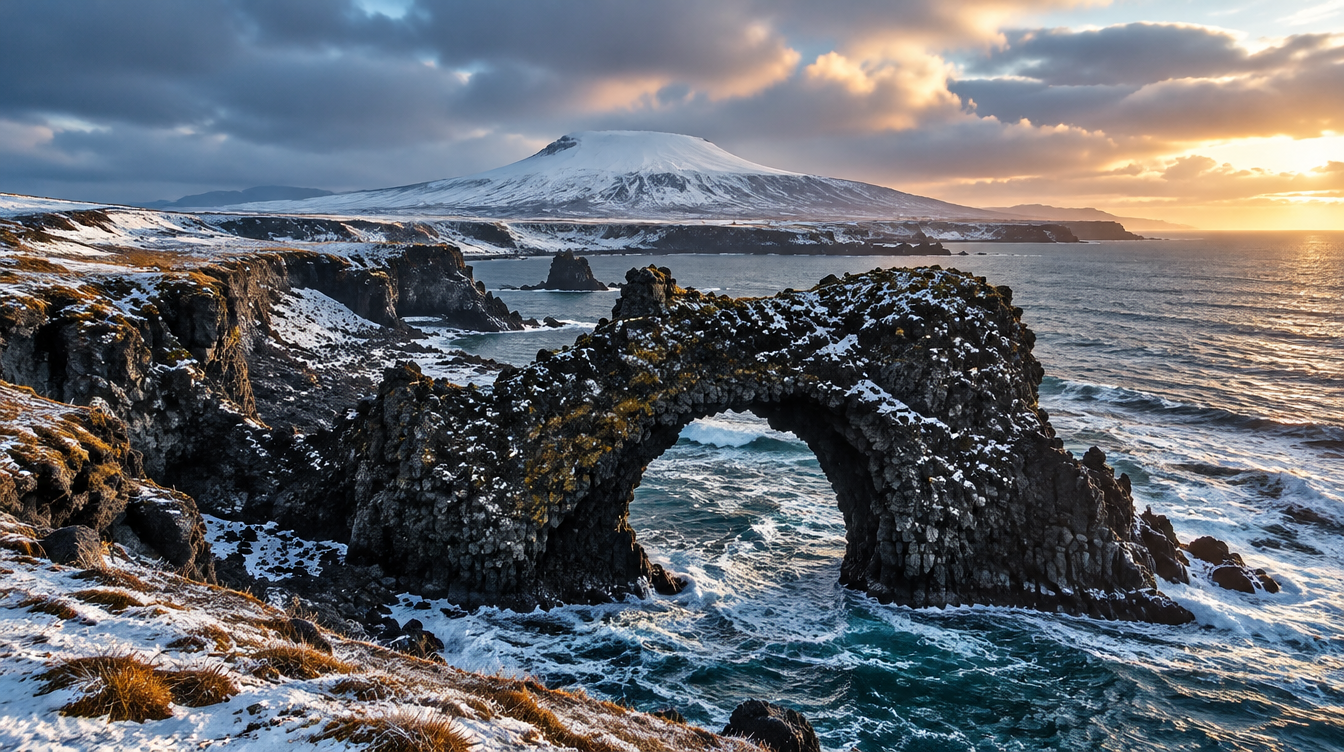
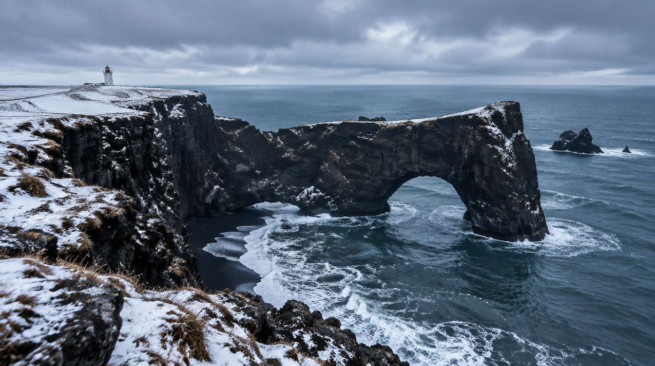
The headline subject at Dyrhólaey is the sea arch the headland is named for, a black lava formation cut by the ocean that is large enough to have had a light aircraft flown through it once, in 1993, which should tell you something about its scale and absolutely nothing about what you should attempt with a drone or anything else on a photography trip. From the upper viewpoint near the lighthouse, you are shooting the arch somewhat side-on, with the open Atlantic behind it and the coastline curving away on either side. A wide angle lens in the 16-35mm range earns its keep here, letting you include the arch, the cliff edge, and a slice of sky or sea without stitching a panorama.
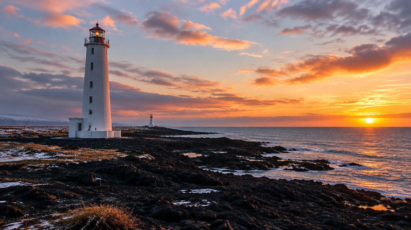
The lighthouse itself, built in 1927 and still standing at the top of the headland, is a strong secondary subject, especially in low winter light when its white tower catches the last color of the day against a darker sky. I like shooting it as a silhouette against sunset color with a longer lens, 70-200mm or similar, compressed against the horizon, as a change of pace from the wide establishing shots everyone takes from the parking area. Bring a polarizer. The light here reflects hard off wet rock and the sea surface, and a polarizer cuts that glare enough to bring back color and contrast you would otherwise lose, particularly on the rock faces below the viewpoint.
There are effectively two viewpoints worth knowing about here: the upper area near the lighthouse, and a lower plateau that gives a different angle down toward the arch and across to Reynisdrangar. Budget enough time to work both rather than treating Dyrhólaey as a five-minute photo stop. Most visitors need roughly 30 minutes for a quick look, but an hour to ninety minutes lets you work both viewpoints without rushing either composition.
About those puffins: why you won't see them on a winter trip
A huge amount of what gets written about Dyrhólaey online is actually about puffins, and almost none of it mentions the one detail that matters most for a winter traveler: you will not see a single one. Atlantic puffins begin egg-laying in April in colonies as far south as Iceland's, with chicks fledging somewhere between 34 and 50 days later, after which the adults head back out to sea and do not return to land again until the next breeding season. Iceland holds roughly 60 percent of the world's Atlantic puffin population, with the Westman Islands alone accounting for about half of that, and Dyrhólaey's own colony is a genuine summer draw for exactly that reason. On a February or March departure, the clifftop is quiet. No birds, no crowds, no breeding-season fencing. Just the rock, the arch, and whatever the Atlantic throws at you that day.
Worth knowing: the species is IUCN-listed as Vulnerable, having been upgraded from Least Concern in 2015, which is part of why seasonal access restrictions exist at some nesting sites around Iceland, Dyrhólaey included, in the spring. More on that below. For a winter trip, treat the absence of puffins as a trade you are making on purpose in exchange for empty viewpoints, dramatic weather, and the chance of aurora after dark.
Looking down vs. looking up: composing Reynisdrangar from above and from the beach
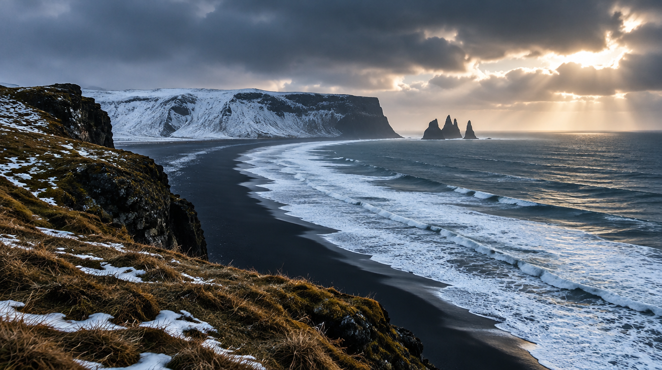
Once you accept that Dyrhólaey and Reynisfjara are two compositions of the same subject, the practical question becomes how to actually shoot each one well. From Dyrhólaey, you are working with elevation as your main compositional tool. Use it. A wide lens with the cliff edge, some foreground texture in the grass or rock, and the stacks sitting on the horizon line gives you depth that a beach-level shot simply cannot. Because you are shooting down and across rather than straight at the subject, the stacks read smaller in frame than they do from Reynisfjara, so I usually pair this view with a second, longer-lens composition that isolates just the stacks and the water around them, compressing the scene the way a beach shot never could.
From Reynisfjara, by contrast, you are at sea level looking almost straight up, and the stacks dominate the frame in a way that makes the beach's basalt columns and black sand genuinely useful foreground elements. The dedicated guide covers that approach properly, but the short version is that the two views reward different gear: wide and elevated at Dyrhólaey, wide-to-normal and ground-level at Reynisfjara, with a longer lens at both if you want a third composition from either spot.
Winter access, the switchback road, and the seasonal closure
Access to Dyrhólaey is by a steep switchback road up to the clifftop, which was rebuilt and paved in 2022, making it a more straightforward drive than it used to be in dry conditions. In winter, treat that road with real caution. A paved switchback is still a switchback, and ice, wind, and reduced visibility can all make the climb genuinely difficult in a way summer visitors never have to think about. Check conditions before you drive up, and do not attempt it in a vehicle without appropriate tires or in conditions you would not otherwise drive in.
The reserve also has a seasonal access restriction in spring to protect nesting birds, generally reported to fall somewhere in the May to late June window and reassessed annually, with upper and lower sections sometimes treated differently. This does not affect a February or March winter trip at all, since it falls well outside the nesting closure period, but it is worth knowing if you are the kind of photographer who might come back for a shoulder-season visit later. Because official notices on this can change year to year, confirm current closure dates directly with Icelandic authorities or on-site signage rather than relying on any single published date, including this one.
Safety on an exposed clifftop: wind, ice, and the edge
Dyrhólaey's upper viewpoints are unfenced in most places, which is part of what makes the photography good and part of what makes the location genuinely dangerous in winter wind. Icelandic coastal wind on an exposed headland can gust hard and without much warning, and a gust that catches you off balance near an edge with a 120-meter drop is not a risk worth taking for a slightly better composition. I keep my tripod legs wide and low to the ground in wind rather than extended to eye level, shoot handheld with image stabilization when gusts are strong enough to shake a planted tripod anyway, and never back up toward the edge while looking through a viewfinder. Check the forecast from the Icelandic Meteorological Office before you commit to a clifftop sunrise or sunset session here. It is the authoritative live source for south-coast wind and weather, and a wind warning the night before is reason enough to shoot Reynisfjara instead, or to simply wait a few hours.
Pro Tip: If the forecast shows sustained wind above roughly 20-25 mph on the clifftop, leave the tripod in the car and shoot handheld at a faster shutter speed instead. A sharp handheld frame beats a blurred one from a tripod that got knocked mid-exposure, and no single photograph is worth going over that edge to retrieve a dropped lens cap.
If the weather only gives you one shot: Dyrhólaey or Reynisfjara
On a seven-day winter itinerary, you do not always get to shoot both locations properly. Weather windows close, the group has a schedule, and sometimes a storm genuinely only gives you time for one stop. Here is the decision framework I actually use in the field, and it comes down to which hazard is the bigger problem that day.
| Factor | Dyrhólaey | Reynisfjara |
|---|---|---|
| Vantage point | Elevated clifftop, looking down and across | Sea level beach, looking up and out |
| Main winter hazard | Unfenced edge, wind exposure, icy access road | Sneaker waves at the shoreline |
| Best when | Low cloud or flat light flattens the beach view, or wind is manageable | Wind is the dominant hazard and you want more shelter near the cliff base |
| Lens approach | Wide angle for the arch and coastline, longer lens for compression | Wide to normal for the stacks and basalt columns at ground level |
| Weather dependency | Needs decent visibility to see the glacier and full coastline | Works in flatter light since the stacks dominate the frame regardless |
| Time needed | 30 minutes minimum, 60-90 for both viewpoints | 45-60 minutes for a proper session |
As a rule of thumb: choose Reynisfjara when wind is the main hazard, since the beach sits lower and gets more shelter at the base of the cliffs than the exposed clifftop does. Choose Dyrhólaey when flat light or low cloud is the bigger problem, since the elevation gives you compositional options that do not depend entirely on strong directional light the way a beach-level shot often does. Either way, check the live forecast before you decide, not the night before, since conditions on this coast can shift meaningfully within a few hours.
Best light and timing for winter photography at Dyrhólaey
Winter works in your favor here in one specific way: the sun stays low for most of the short daylight window, so you are not fighting harsh midday light the way you would be at the height of summer. A February or March sunrise or sunset session can give you warm, raking light across the arch and the cliff face for longer than you would expect, since the sun never climbs particularly high even at midday this far north in winter. Bring a graduated neutral density filter if you shoot stills rather than bracketing, since the gap between a bright sky and darker foreground rock is often more than a single exposure can hold cleanly, especially right at sunrise or sunset.
Arrive with enough time before your target light to scout both the upper lighthouse area and the lower plateau, since the best angle on any given day depends on cloud cover and exactly where the light is breaking through. I generally shoot a wide establishing frame first to bank the safe version of the shot, then work more deliberate compositions once I know what the light is actually doing.
Where this fits on a real Iceland winter itinerary
On WeShoot's Iceland Winter Aurora tour, this stretch of coastline, Dyrhólaey, Reynisfjara, and the Reynisdrangar stacks, all falls on the same day of the itinerary, which is exactly how I would recommend tackling it even on a self-planned trip. The current departure runs 7 days and 7 nights with luxury accommodation throughout, a maximum of 10 participants, and one professional photographer guide on the ground, Lorenzo Ranieri Tenti on the upcoming March departure. It includes all ground transportation and airport transfers from the Keflavík meeting point, breakfasts plus five dinners, professional coaching, image review sessions, and a post-processing workshop built into the week, for $4,500 per person with a $1,350 deposit to book. International flights and travel insurance are not included. If you want the clifftop-and-beach pairing covered in this guide handled for you, with someone standing next to you reading the wind and calling the shot between the two locations in real time, that is precisely the day this tour is built around.
For the rest of the cluster this location sits inside, our Iceland winter photography guide is the place to start if you have not already, and the Vestrahorn and Stokksnes guide covers the other mountain-and-reflection location most winter itineraries build a day around, further east along the same coast.
Frequently asked questions
Is Dyrhólaey the same place as Reynisfjara? No. They are two separate, nearby stops on Iceland's south coast that both offer views of the Reynisdrangar sea stacks. Dyrhólaey is an elevated promontory with a clifftop arch and lighthouse; Reynisfjara is the black sand beach below, reached by its own access road. You drive between the two, you cannot walk from one to the other.
Will I see puffins at Dyrhólaey in winter? No. Puffins nest here roughly from spring through late summer and spend the rest of the year out at sea. A February or March visit will have no puffins at all. Go for the arch, the light, and the clifftop view instead.
Is the sea arch itself accessible, or only visible from above? The clifftop viewpoint looks down and across at the arch; it is a subject you photograph from above or the side rather than something you walk through. A light aircraft is on record as having flown through it once, in 1993, which is not something a visiting photographer should try to replicate on foot or by drone.
Does Dyrhólaey ever close? Parts of the reserve are seasonally restricted in spring to protect nesting birds, generally falling somewhere between May and late June and reassessed annually. This does not affect winter-season visits. Always confirm current access rules on-site or with official Icelandic sources before you drive up, since dates and rules can change year to year.
How far is Dyrhólaey from Vík or Reykjavík? Vík, the nearest village, is about 180 km (110 mi) southeast of Reykjavík on Route 1. Dyrhólaey sits just off that road a short distance before Vík, making it an easy add-on stop rather than a detour.
Which is safer to shoot in bad weather, Dyrhólaey or Reynisfjara? Both carry real winter hazards, just different ones. Dyrhólaey's clifftop is unfenced and exposed to wind, with an access road that can ice over. Reynisfjara's danger is sneaker waves at the shoreline. Neither is inherently safer; the right choice depends on whether wind or wave conditions are the bigger problem that day.
How long should I budget for Dyrhólaey? Most visitors need roughly 30 minutes for a quick viewpoint stop, or up to an hour to an hour and a half to properly work both the lighthouse and arch viewpoint and the lower plateau view toward Reynisdrangar.
What about the parking fee? Reports on this vary and seem to change, so rather than quote a figure that might be wrong by the time you arrive, budget for the possibility of a small fee and confirm it from the signage on site.
Sources
- Dyrhólaey: Wikipedia entry on geology, formation, the lighthouse, and access road
- Reynisdrangar: Wikipedia entry on the sea stacks, folklore, and Reynisfjara beach rankings
- Atlantic puffin: Wikipedia entry on breeding season, Iceland population, and conservation status
- Vík í Mýrdal: Wikipedia entry on distance from Reykjavík and village status
- Icelandic Meteorological Office: official live weather and conditions for south Iceland