Val d'Orcia Explained: Why Photographers Call It the Soul of Tuscany
What Val d'Orcia actually is, why its clay hills look the way they do, and what its UNESCO status means for anyone visiting with a camera.
Val d'Orcia Explained: Why Photographers Call It the Soul of Tuscany
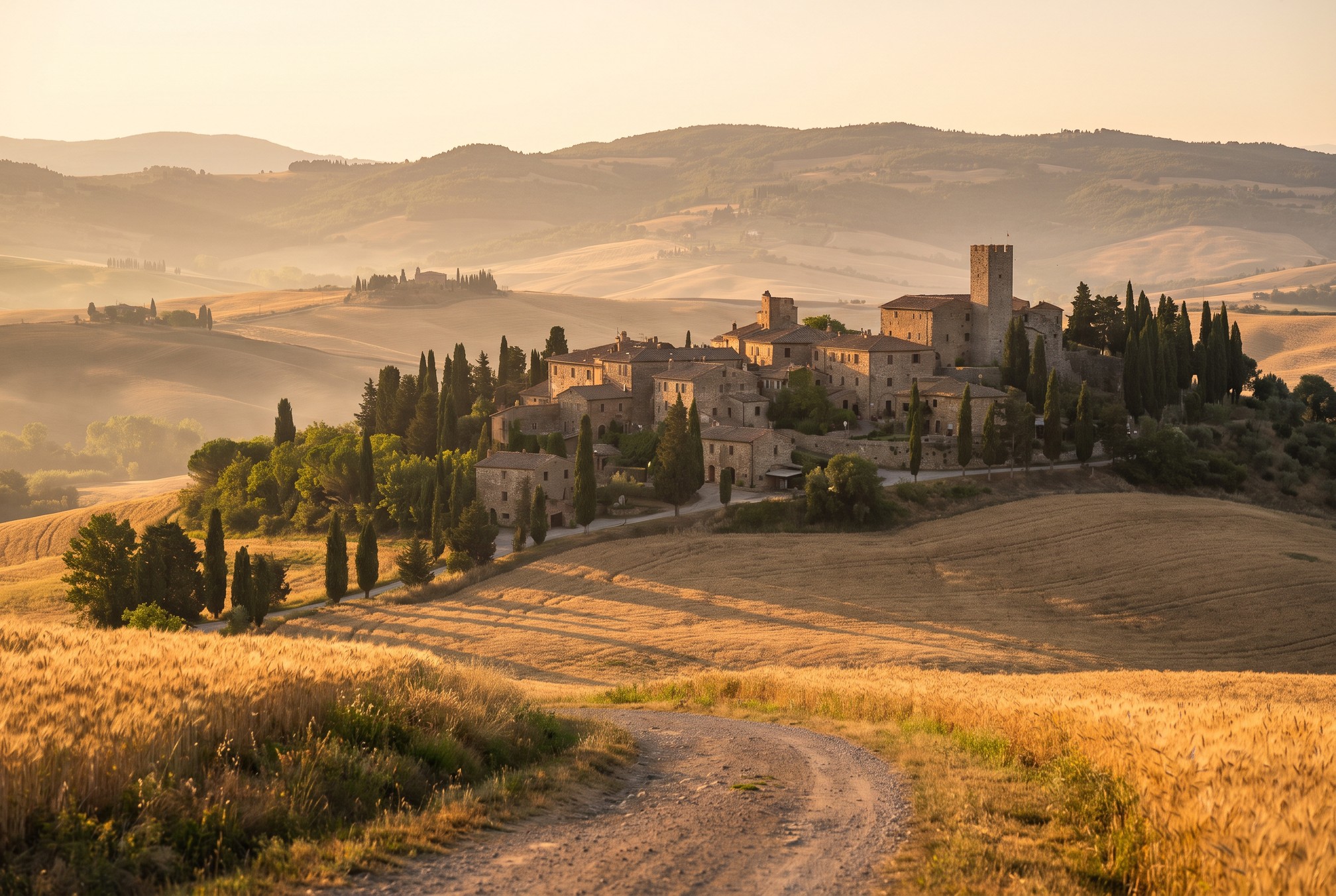
Type "Tuscany" into an image search and a surprising share of the results will not actually be Tuscany in the broad sense at all. They will be one specific corner of it: a narrow, quiet valley south of Siena where cypress trees line gravel roads, farmhouses sit alone on rounded hilltops, and the light seems to know exactly when to show up. That corner has a name, and it comes up constantly in photography forums, workshop itineraries, and caption after caption on social media without much explanation of what it actually is. This guide fills in that gap.
Val d'Orcia is not a town, and it is not a vague marketing label for "the pretty part of Tuscany." It is a specific, legally defined landscape with borders, a UNESCO designation, a working agricultural economy, and a history that explains why it looks the way it does. Understanding that background will not just satisfy curiosity. It will change how you plan a trip, where you point your camera, and why some of the compositions you have seen online are so much harder to recreate than they look.
Key Takeaways
Val d'Orcia is a specific, UNESCO protected valley south of Siena, not a generic name for the Tuscan countryside.
| Point | Details |
|---|---|
| What it is | A roughly 61,000 hectare valley following the Orcia river, spanning the provinces of Siena and Grosseto |
| UNESCO status | Inscribed as a World Heritage Site in 2004, recognized as an outstanding example of a Renaissance ideal landscape |
| Why it looks this way | Centuries of managed agriculture on soft clay hills, not an untouched wilderness |
| Anchor towns | San Quirico d'Orcia, Pienza, Montalcino, and the hamlet of Bagno Vignoni |
| Best base for photographers | San Quirico d'Orcia or Pienza, both central to the cypress roads and hilltop viewpoints |
Table of Contents
- So what exactly is Val d'Orcia
- Where it sits on the map
- Why the hills look the way they do
- A landscape people fought to protect
- The towns that anchor the valley
- A working landscape, not a stage set
- Why photographers single out this one valley
- Frequently asked questions about Val d'Orcia
- Planning your first look at the valley
So what exactly is Val d'Orcia
Val d'Orcia, literally "the valley of the Orcia," is the stretch of countryside that follows the Orcia river as it cuts through the hills south of Siena on its way toward Monte Amiata, the extinct volcano that dominates the southern skyline. The name refers to a specific geographic and administrative area, not a loose regional nickname. Since 2004 it has also been the official title of a UNESCO World Heritage Site covering roughly 61,000 hectares, with an additional buffer zone of about 5,700 hectares protecting the land immediately surrounding it.
That distinction matters more than it sounds like it should. A lot of first time visitors assume "Val d'Orcia" is simply a synonym for scenic Tuscany and plan their route accordingly, driving through Chianti or the hills near Florence expecting the same rolling, cypress lined compositions they saw in a photograph captioned "Tuscany." Chianti is beautiful in its own right, but it is a different landscape with different vegetation, different hill shapes, and a different history. If a specific photograph pulled you toward this region, there is a good chance it was taken here, in Val d'Orcia, and knowing that narrows your route planning considerably.
Where it sits on the map
Val d'Orcia sits almost entirely within the province of Siena, with its southern edge extending into the province of Grosseto near Monte Amiata. It is roughly a 45 minute drive south of Siena itself, and about two hours south of Florence by car, which makes it a realistic day trip from either city but a much better multi-day base if photography is the actual goal rather than a side activity.
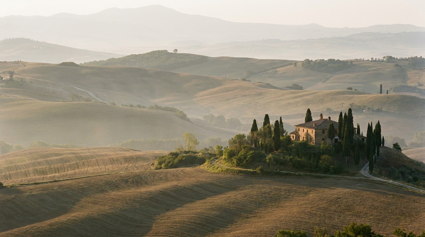
The valley is compact enough to explore without constant long drives, which is part of what makes it so efficient for a photography trip. San Quirico d'Orcia sits roughly in the middle, with Pienza a short drive to the east, Montalcino to the northwest, and the thermal square of Bagno Vignoni just a few minutes south. Most of the compositions you have seen associated with Val d'Orcia, the winding cypress roads, the solitary farmhouses on rounded hills, the fog pooling below hilltop towns, sit within about a twenty minute drive of that central point.
Pro Tip: Base yourself in or near San Quirico d'Orcia rather than Siena or Florence if photography is the priority. The extra thirty to sixty minutes of driving each city adds up fast when your best shooting windows are twenty minutes around sunrise and sunset.
Why the hills look the way they do
The rounded, almost sculptural shape of the hills in Val d'Orcia comes down to geology as much as anything else. Much of the valley sits on soft clay soil, in places eroded into the pale, ridged formations locally called "biancane" and "calanchi." That clay does not hold sharp edges the way limestone or granite does, so instead of jagged ridgelines you get the smooth, rolling profiles that make the region so photogenic and so easy to recognize from a single frame.
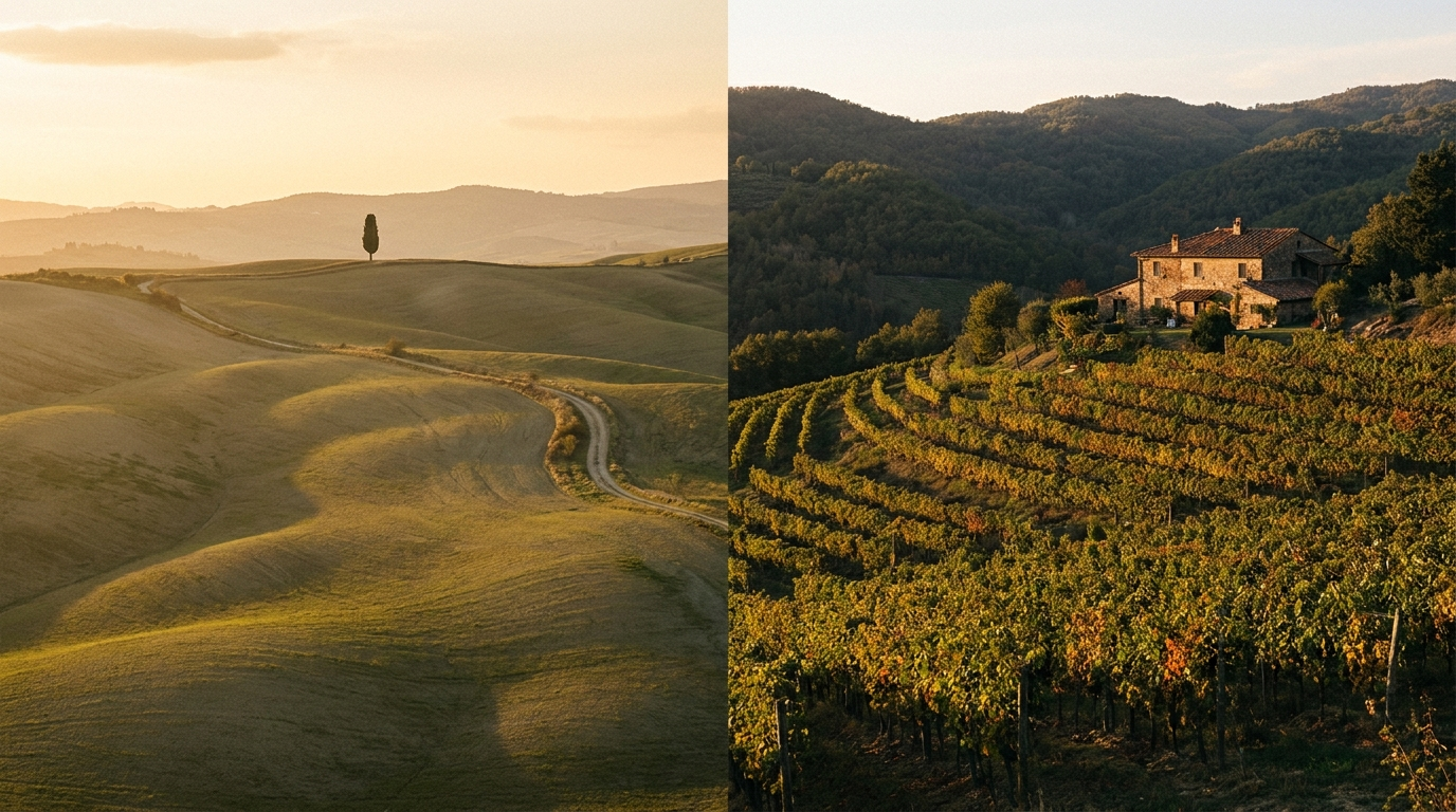
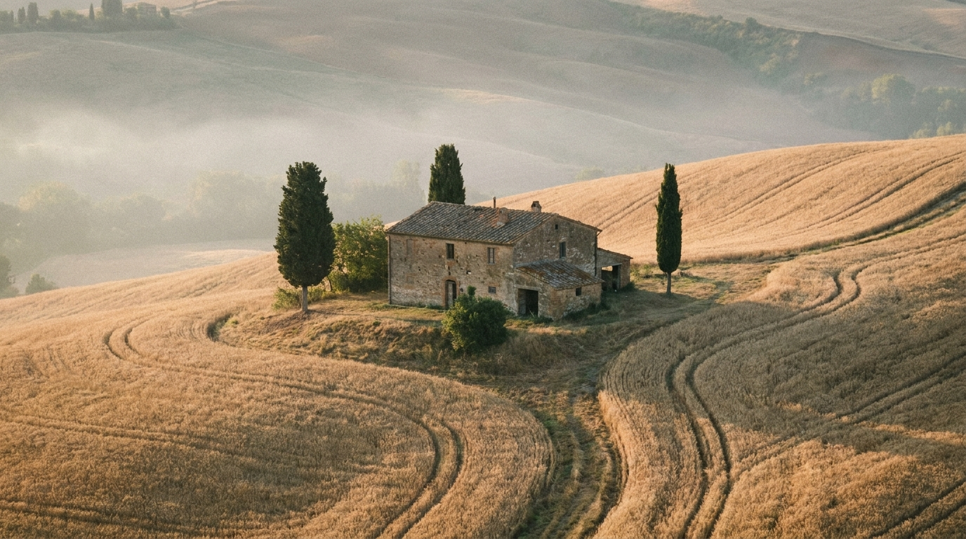
Centuries of farming reinforced that shape rather than fighting it. Wheat, and now also sunflowers, grapes, and olives, are planted in sweeping curves that follow the contour of each hill, which is partly practical for erosion control and partly the accidental result of generations of farmers working the same land the same way. The solitary cypress trees and small farmhouses that anchor so many compositions were placed for shade, wind protection, and boundary marking, not for how they would look in a photograph two hundred years later. The landscape is beautiful largely because it is functional, which is worth remembering the next time a comparison piece calls it a "postcard" scene.
A landscape people fought to protect
UNESCO does not hand out World Heritage status for scenery alone. Val d'Orcia was inscribed in 2004 under criteria that recognize it as an outstanding example of how a Renaissance vision of an "ideal landscape" was translated directly into the land itself, and as a landscape that has retained an exceptional degree of visual harmony and quality of land management for centuries. In plainer terms, the committee was recognizing something unusual: a working agricultural region that looks the way fifteenth century artists and writers imagined a perfect countryside should look, and has stayed that way through active, ongoing stewardship rather than by accident.
That designation has real consequences for anyone visiting with a camera. Building restrictions inside the protected zone are strict, which is a large part of why the valley has so few visible power lines, billboards, or modern developments breaking up a wide shot. It also means access to some of the most photographed farmland is genuinely private property, farmed by families who did not sign up to have their driveway photographed by strangers at sunrise. We will come back to that when we cover the individual cypress roads and viewpoints in later guides, but it is worth internalizing early: the protection that keeps this landscape photogenic is the same protection that requires visiting it with some restraint.
The towns that anchor the valley
A handful of towns give the valley its structure, each with a distinct character worth knowing before you build an itinerary. San Quirico d'Orcia is the most centrally located, a walled medieval town that makes a practical home base. Pienza, a few miles east, was rebuilt in the fifteenth century under Pope Pius II as a model of ideal Renaissance town planning, and its terrace views over the valley are some of the most photographed in the region. Montalcino, perched higher and further northwest, is known internationally for Brunello di Montalcino wine as much as for its own hilltop views. Bagno Vignoni is smaller still, built around a central square filled with steaming thermal water instead of a piazza, which makes it one of the strangest and most distinctive stops in the valley.
| Town | Known for | Best for photographers |
|---|---|---|
| San Quirico d'Orcia | Central location, medieval gates, walkable historic core | A practical home base with easy access to the cypress roads |
| Pienza | Renaissance "ideal town" planning under Pope Pius II | Terrace views over the valley and Piazza Pio II |
| Montalcino | Brunello di Montalcino wine, hilltop fortress | Wide elevated views over the northern valley |
| Bagno Vignoni | A central square filled with thermal water instead of stone | Reflections and steam, especially at sunrise |
Each of these deserves its own detailed walking guide, and we will be publishing exactly that over the coming weeks, starting with San Quirico d'Orcia. For now, treat this as the map you need to make sense of everything else on this journal, since later posts will assume you know roughly where each of these towns sits relative to the others.
A working landscape, not a stage set
It is easy to look at a wide shot of Val d'Orcia and read it as pure scenery, but almost every element in frame has an economic purpose. The wheat fields are commercial wheat fields. The vineyards around Montalcino support a wine industry that exports around the world. The cypress trees along the famous roads were often planted as windbreaks or property markers by farming families whose descendants may still work that same land today.
That matters practically because it means the "empty" farmland you see in a photograph is rarely empty in the legal sense. Roads through the countryside are public, but the fields on either side generally are not, and farmers in this region have understandably grown less patient with photographers who climb over gates or trample a crop row for a slightly better angle. None of this should discourage a visit. It should just recalibrate the expectation from "empty wilderness, shoot from anywhere" to "working farmland, shoot respectfully from the road or with permission," which is the same etiquette that applies to farmland back home in the United States.
Why photographers single out this one valley
Tuscany is a large region, and plenty of it is scenic. What sets Val d'Orcia apart, and what keeps drawing photographers back to this specific 61,000 hectares rather than the broader countryside around it, is the combination of open sightlines and dramatic elevation change packed into a small area. The clay hills rise and fall enough to create genuine foreground, midground, and background layers in a single frame, something flatter agricultural land struggles to produce. Add in low, warm light for a large part of the year, minimal visual clutter thanks to the UNESCO building restrictions, and a road network that lets you reach a dozen strong viewpoints in a single morning, and you get a landscape that rewards photographers more reliably, per hour spent shooting, than almost anywhere else in the country.
There is also a feedback loop worth acknowledging. Val d'Orcia has been photographed so often, by so many professionals and amateurs alike, that certain compositions have become genuinely iconic: a single cypress on a rounded hill, a farmhouse framed by two curving rows of trees, fog below a hilltop town at sunrise. Chasing those specific shots is not a bad goal for a first trip, but the valley rewards photographers who spend a little time looking for their own angle on a familiar scene rather than only replicating the most famous one.
Frequently asked questions about Val d'Orcia
Is Val d'Orcia a town or a region? It is a region, a defined valley and UNESCO World Heritage landscape containing several separate towns including San Quirico d'Orcia, Pienza, and Montalcino, plus the smaller hamlet of Bagno Vignoni.
How far is Val d'Orcia from Florence? Roughly two hours by car, and closer to forty five minutes from Siena, which sits just north of the valley.
Is Val d'Orcia the same as Chianti? No. Chianti lies north of Siena and is a separate wine region with its own distinct hill shapes and vegetation. Val d'Orcia sits south of Siena and has a different geology and history, though both are frequently photographed under the general label "Tuscany."
What does the UNESCO designation actually protect? It protects the visual and agricultural character of the landscape through building and development restrictions, aiming to preserve the valley as a living example of a Renaissance ideal countryside rather than freezing it as an untouched wilderness.
Do I need a car to visit Val d'Orcia? Practically speaking, yes. Public transport connects the larger towns but does not reach most of the viewpoints, cypress roads, or farmland vistas that photographers come for.
Planning your first look at the valley
If this is your first real introduction to Val d'Orcia, the single most useful thing to take away is that it rewards slowing down. It is a small enough area to see the highlights in two or three days, but a landscape this dependent on light changes completely between a flat midday visit and a session timed around sunrise or sunset. Photographers who treat it as a checklist of towns to drive through tend to come home with competent but forgettable images. Photographers who pick a base, learn the roads, and return to the same viewpoint at different times of day tend to come home with the shots that made them want to visit in the first place.
Our Tuscany Photography Guide is the best starting point for building an actual itinerary, and our guide to the best time to photograph Tuscany will help you match your travel dates to the season that fits what you want to shoot. Over the coming weeks we will be publishing individual walking guides to San Quirico d'Orcia, Pienza, Bagno Vignoni, and the quieter village of Monticchiello, each going into the street level detail this overview does not have room for.
Sources
- UNESCO World Heritage Centre: Val d'Orcia, official listing and inscription criteria
- Val d'Orcia: Wikipedia entry on geography and history