Drone Photography in Tuscany: What US Visitors Need to Know Before Flying
A practical, non legal advice guide to EASA and ENAC drone rules for US visitors photographing Val d'Orcia, from operator registration to no fly zones around historic hilltop towns.
Drone Photography in Tuscany: What US Visitors Need to Know Before Flying
I get some version of the same email every few weeks from a reader packing for Val d'Orcia. "I just bought a drone, can I fly it over the cypress road near San Quirico?" The honest answer is almost always yes, but the paperwork to get there legally is more involved than most US photographers expect, and it is nothing like the FAA registration most of us are used to at home. This is not legal advice, and rules change, so treat everything here as a starting point for your own research rather than a final word. What I can offer is the practical view of someone who has actually gone through the process as a visiting pilot and flown a drone over this specific stretch of Tuscany more than once.
The short version is that Europe runs on one unified drone framework called EASA, Italy layers its own national requirements on top through ENAC and a platform called D-Flight, and the actual flying part, once you clear the paperwork, is refreshingly simple in most of Val d'Orcia because it is rural, open countryside with very few restricted zones outside the historic hilltop towns themselves. Get the registration and the airspace check done before you land in Italy, not after, because none of it can be sorted out productively while jet lagged in a rental car outside Pienza.
Key Takeaways
US visitors need an EASA drone operator registration before arrival, plus an Italian D-Flight account for airspace checks once in country, and historic town centers are effectively off limits to takeoff and landing.
| Point | Details |
|---|---|
| Register once for the whole EU | An EASA operator registration done in any single EU member state covers you across all of them, Italy included |
| Do it before you fly, not on arrival | Registration and the operator ID sticker on your drone should be sorted before your trip starts |
| Italy adds its own layer | ENAC requires a D-Flight account for airspace checks and, for most drones, a separate Italian flight authorization |
| Historic centers are largely no fly | San Quirico, Pienza, and Montepulciano's old towns sit inside restricted or sensitive zones, so plan aerial shots from farmland outside the walls instead |
| Sub 250g drones have real advantages | Drones under 250 grams, like the DJI Mini series, face fewer restrictions and simpler registration than heavier models |
| Weather is your bigger obstacle in practice | Val d'Orcia's ridge top wind, especially in afternoon, grounds more flights than any regulation does |
Table of Contents
- Do you even need a drone here
- Registering as a US pilot under EASA rules
- The Italy specific layer: ENAC and D-Flight
- Open category subcategories: what A1, A2, and A3 mean for you
- No fly zones around historic centers
- Planning a shoot around terrain and light
- Camera settings and gear for drone landscape work
- What actually looks good from the air in Val d'Orcia
- Mistakes US visitors make
- Frequently asked questions about droning in Tuscany
Do you even need a drone here
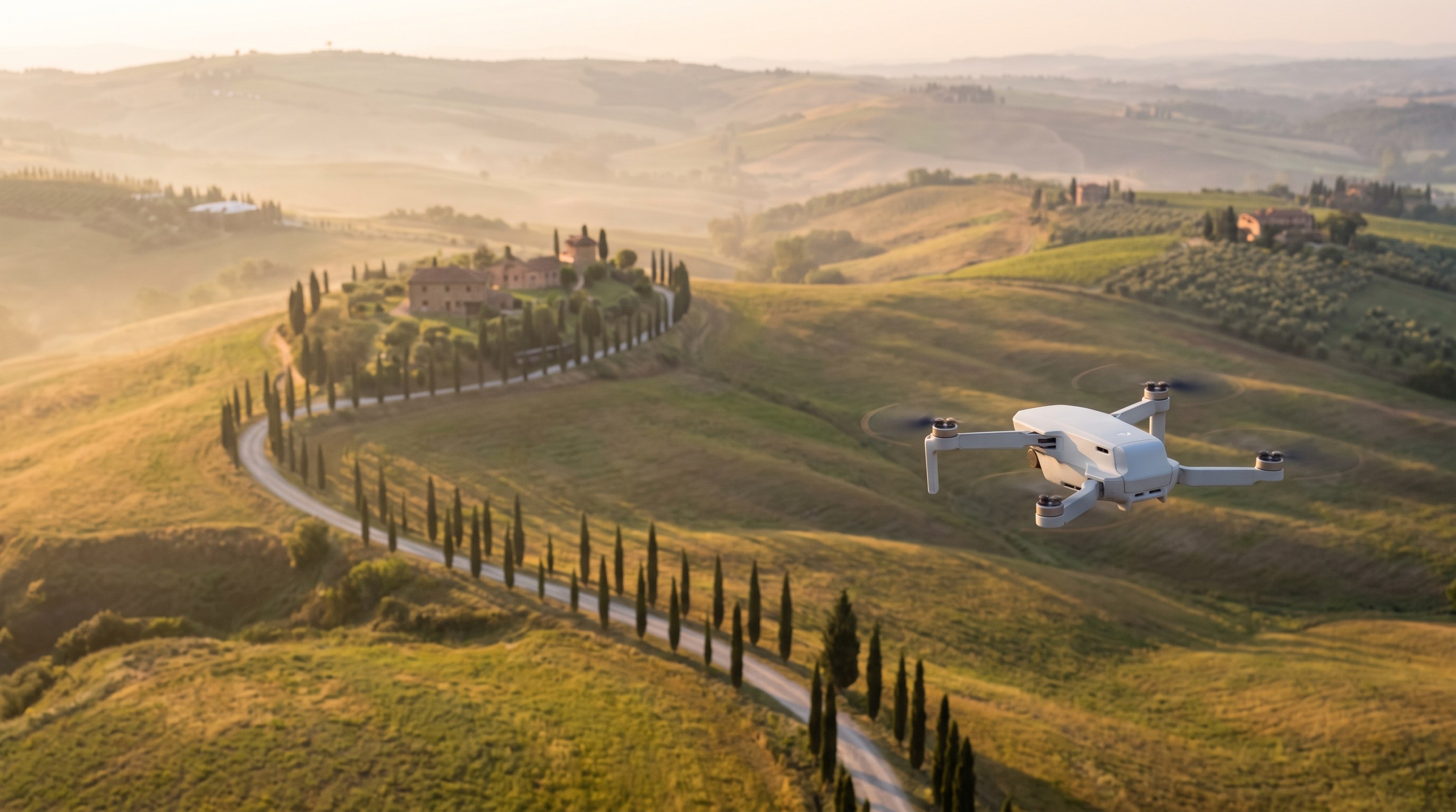
Before we get into paperwork, it is worth being honest about whether Val d'Orcia even needs a drone. A huge share of the region's most photographed compositions, the winding cypress driveways, the Pienza terrace looking south over the valley, the fog pooling below a hilltop town, were shot from the ground with a wide or telephoto lens and work perfectly well that way. A drone adds a genuinely different perspective, mostly on the rolling hill patterns themselves, the geometric farm fields of the Crete Senesi just east of Val d'Orcia proper, and isolated farmhouses sitting on top of a hill with a single access road curling up to them. If your shot list is heavy on those wide, graphic, top down patterns, a drone earns its place in your bag. If you mostly want intimate shots of stone villages and cypress lined roads at eye level, you can leave it at home and save yourself the registration hassle entirely.
I regularly meet visiting photographers who bought a drone specifically for a Tuscany trip, then used it twice in a week because the paperwork and the wind made it more trouble than it was worth. Decide honestly whether the shots you actually want require altitude before you commit to the process below.
Registering as a US pilot under EASA rules
The European Union Aviation Safety Agency, EASA, sets one common set of drone rules across the EU, which is genuinely helpful once you understand it, because it means a single registration covers you in Italy, France, Germany, and every other EU member state rather than requiring a country by country process the way some regions of the world do. As a US citizen with no EU drone registration on file, you need to register as a drone operator through the online portal of any single EU member state before you fly commercially or as a hobbyist above 250 grams, and in practice most non EU visitors register through whichever country's portal is in English and easiest to navigate.
Registration itself is not complicated. You create an account, provide your identity information and a form of liability insurance in some cases, pay a modest fee, and receive an operator registration number. That number then needs to be displayed on every drone you bring, usually as a small printed or written label on the airframe, and it also gets tied to your drone's remote identification broadcast if your model supports it, which nearly all consumer drones sold since 2023 do. Budget at least a few weeks before your trip to get this done, since account verification can take longer than the ten minutes the form itself requires, especially for foreign applicants whose documentation needs manual review.
Pro Tip: Print your operator registration number on a small waterproof label before you leave home and stick it to the drone body, not just the battery. Battery swaps are common mid shoot, and an inspector checking your paperwork in the field wants to see the number on the airframe itself.
Once registered, you also need to think about pilot competency. The EASA open category, which covers the vast majority of hobbyist and semi professional landscape work, requires online theory training and a short exam for anything above the lightest weight class, and for slightly heavier drones a further practical declaration. This is done entirely online, takes an evening to prepare for, and the exam itself is multiple choice and genuinely approachable for anyone who has read through the material once. Do this well before your trip too, since some member state portals require the operator registration to be finalized before the pilot competency certificate can be issued.
The Italy specific layer: ENAC and D-Flight
Here is where things diverge from the simpler picture painted above. Italy, through its national aviation authority ENAC, requires an additional layer on top of the EASA registration for actually flying inside Italian airspace. The mechanism for this is a platform called D-Flight, which functions as both an airspace mapping tool and, for many operations, a registration and notification system specific to Italy. You create a D-Flight account separately from your EASA registration, and the platform lets you check, zone by zone, whether a specific patch of ground is open, restricted, or fully prohibited for drone flight on a given day.
This is genuinely useful in practice, not just bureaucratic box checking. Before I fly anywhere in Tuscany I do not already know well, I pull up the D-Flight map on my phone the night before and again the morning of the shoot, since restricted zones can shift temporarily around events, agricultural work, or wildfire risk during dry summer months. The map uses a simple color system, green for open flying under general rules, yellow for restricted zones needing extra authorization or specific conditions, and red for zones that are essentially off limits without special permission you are very unlikely to obtain as a visiting hobbyist. Val d'Orcia's open farmland is overwhelmingly green on this map. The historic centers of its towns are a different story, which the next section covers in more depth.
Open category subcategories: what A1, A2, and A3 mean for you
Nearly every landscape photographer flying a consumer drone in Tuscany falls under what EASA calls the open category, the lowest risk tier, which is further split into three subcategories that determine how close you can fly to people and what training you need. Getting this right matters because it directly shapes which shots are even legally available to you around a populated area like a Val d'Orcia hilltop town.
| Subcategory | Typical drone weight | Distance from uninvolved people | What it means for a Tuscany trip |
|---|---|---|---|
| A1 | Under 250g (class C0), or under 900g with class C1 marking | May fly close to but not directly over crowds | The most flexible subcategory. A DJI Mini class drone under 250g gives you the least restrictive option for village edges and farm roads |
| A2 | Under 4kg with class C2 marking | 30 meters horizontally from uninvolved people, 5 meters in low speed mode | Covers mid size drones like a Mavic 3 class aircraft, requires the further A2 remote pilot certificate beyond basic theory training |
| A3 | Any open category drone without a class marking, or up to 25kg | 150 meters from residential, commercial, industrial, or recreational areas | The most restrictive for populated terrain, which rules out most hilltop town flying entirely and pushes you to open countryside |
For most visiting landscape photographers, a sub 250 gram drone in the A1 subcategory is the path of least resistance, both for the lighter registration burden and for the practical flexibility of shooting near, though not directly over, the edges of a village or a farmhouse. I fly a Mini class drone specifically for Tuscany trips for this reason, even though I own heavier drones with better sensors, because the legal flexibility around populated terrain outweighs the modest image quality gap for most of the compositions this region rewards.
No fly zones around historic centers
This is the part visiting photographers get wrong most often, so it deserves its own section. The historic centers of Pienza, San Quirico d'Orcia, and Montepulciano sit inside what Italian regulation treats as sensitive or restricted zones, partly because of their UNESCO World Heritage status within the broader Val d'Orcia designation, partly because dense stone construction and narrow medieval streets create genuine safety concerns for an uncontrolled aircraft above pedestrians. In practical terms, that means takeoff and landing from inside the walls of any of these towns is very unlikely to be legal under a standard open category flight, regardless of which subcategory your drone falls into.
The workaround, and it is a good one rather than a compromise, is that the compositions everyone actually wants from the air in these towns look better from just outside the walls anyway. The classic elevated shot of Pienza's rooftops against the Val d'Orcia backdrop, for example, reads more naturally launched from farmland a few hundred meters outside the historic center, giving you both a legal takeoff point and a wider, more contextual frame that includes the surrounding hills rather than a tight crop of rooftops alone. Check the D-Flight map for your specific launch point before every flight near a town, since the boundary of a restricted zone rarely lines up exactly with where you would guess it does from looking at a map casually.
Pro Tip: Scout your drone launch point on foot the day before, during the same light you plan to shoot in. A farm road that looks like open access on a map sometimes turns out to be a private driveway, and you want that conversation with a landowner to happen calmly in daylight, not while you are trying to launch at 5:45am before sunrise.
Planning a shoot around terrain and light
Once the legal groundwork is sorted, the actual flight planning in Val d'Orcia comes down to two variables that matter more here than almost anywhere else I fly: wind and altitude relative to the ridgelines. This is genuinely hilly terrain, and afternoon thermal wind picking up off sun warmed slopes is a bigger obstacle to a clean flight than any regulation. I plan drone sessions almost exclusively for the first ninety minutes after sunrise, when the air is coolest and calmest, rather than the evening golden hour that ground based photographers usually prefer. By late afternoon, especially in the drier months from June through September, wind gusts along the exposed ridges between San Quirico and Pienza can exceed what a Mini class drone handles comfortably, and even a heavier model starts fighting for stable hover.
Altitude is the other consideration specific to this terrain. Val d'Orcia's hills rise and fall enough that a 120 meter altitude limit measured from your takeoff point can put you uncomfortably close to a ridge crest if you launch from a low valley floor and fly toward higher ground. Check your drone's terrain awareness settings before the trip, and if your model supports it, switch to a mode that measures altitude relative to ground level rather than a fixed takeoff point, since a flat 120 meter ceiling calculated only from launch elevation can put you dangerously close to a hillside you cannot see clearly on a small controller screen.
If you want the fog shots this region is known for, plan your drone flight for the same conditions that produce ground level fog: a clear preceding evening, calm wind, and a sharp overnight temperature drop. A drone above the fog layer at sunrise, looking down on a hilltop town floating on a sea of white with only the bell tower catching the first direct light, is one of the genuinely unique images a drone makes possible here that no ground composition can replicate. Just be aware that the same calm, clear conditions that produce fog can also mean colder temperatures that drain a drone battery noticeably faster than a mild afternoon flight, so budget extra battery margin on a fog morning.
Camera settings and gear for drone landscape work
Drone sensors are small relative to a full frame mirrorless body, which means dynamic range is more limited and highlight recovery is less forgiving, especially shooting directly into a rising sun over the hills. I shoot RAW exclusively, never the compressed JPEG the drone defaults to, and I keep ISO pinned at the drone's base value, usually 100, letting shutter speed and a variable ND filter handle exposure rather than pushing ISO up in marginal light. A set of ND filters, typically ND8 through ND32 depending on conditions, is genuinely essential kit for a drone in bright Tuscan sun, since without one you are often stuck with a shutter speed too fast to produce smooth, natural looking rotor blur on any horizon level footage, and stills come out slightly harsher in contrast than the same scene shot with a proper neutral density filter dialed in.
For pure stills of the rolling hill patterns, I shoot straight down or at a 30 to 45 degree oblique angle rather than the more dramatic near horizontal angle that looks better for establishing shots. The steeper angles flatten the hill topology into the graphic, almost abstract patterns that make Val d'Orcia's farmland so distinctive from the air, an effect that gets lost the closer you get to a horizon level composition. Bracket your exposures when shooting into strong morning side light, three frames at one stop apart is usually enough, and blend in post if the dynamic range exceeds what a single RAW file recovers cleanly, which happens more often with a small drone sensor than most photographers expect coming from a larger format camera.
If aerial landscape work is becoming a bigger part of your kit, it is worth building real flight time into a trip rather than treating the drone as an afterthought squeezed between ground sessions. Our Val d'Orcia photography tours build in dedicated windows at the locations that actually reward an aerial perspective, and having a guide who already knows which farm roads offer a legal, safe launch point saves you the scouting time that otherwise eats into your best light on a short trip.
What actually looks good from the air in Val d'Orcia
Not every ground composition translates well to an aerial view, and knowing which ones do saves you from burning battery cycles on shots that looked promising on the ground but read as flat and directionless from above. The farmland patterns of the Crete Senesi, with their bare clay hills and curving field boundaries, are probably the single best aerial subject in the wider region, since the graphic shapes only really resolve from a genuine bird's eye or steep oblique angle. Isolated farmhouses at the top of a switchback driveway, a signature Val d'Orcia composition, also gain a lot from altitude, since a drone can reveal the full curling shape of the access road that a ground shot only implies.
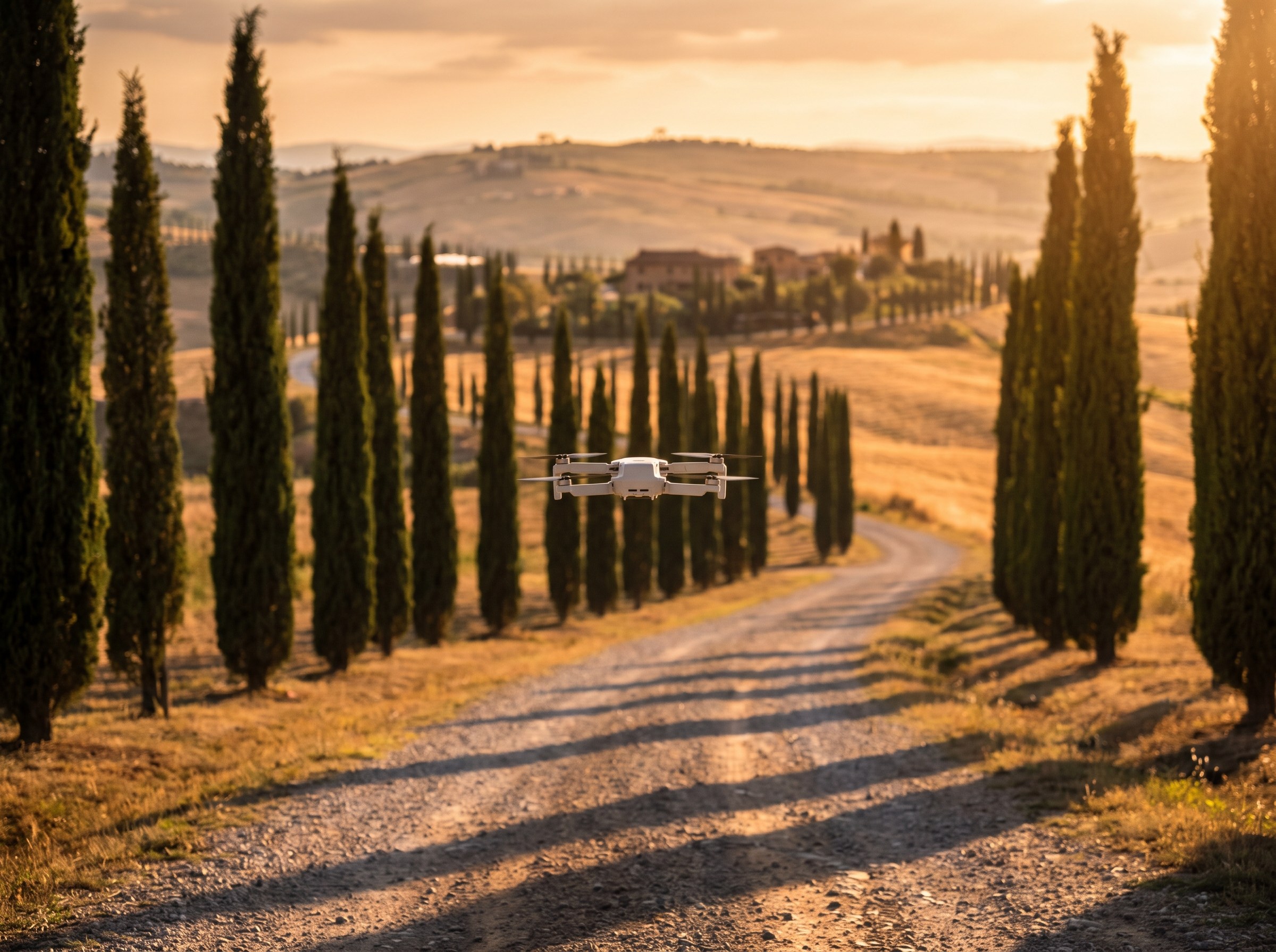
The famous cypress lined roads near San Quirico work well from a moderate height too, roughly 40 to 60 meters, high enough to show the full line of trees receding into the hills without flattening the sense of depth entirely the way a straight down shot would. I generally avoid flying directly over the road itself at low altitude out of respect for other photographers working the same spot from the ground, and it also tends to produce a less interesting angle than working from just off to one side, which keeps a sense of the road's curve rather than reducing it to a straight line running to the frame edge.
Mistakes US visitors make
The single most common mistake is assuming FAA Part 107 or recreational registration carries any weight in Europe. It does not. US certification, no matter how thorough, has no legal standing under EASA rules, and flying without the correct European registration is a real enforcement risk, not just a technicality. The second most common mistake is registering correctly but never actually opening D-Flight before arriving, then discovering on the first morning of a trip that a planned launch point sits inside a restricted zone with no obvious way to tell from looking at the physical landscape. Check D-Flight before you leave home, not after you land jet lagged and eager to fly.
The third mistake, with less legal consequence but a real creative cost, is treating altitude as automatically better. I have watched photographers climb straight to the legal ceiling on every flight out of habit, when the strongest image was often sitting at 40 or 50 meters with a more considered angle. Fly with intention toward a specific composition rather than maximizing height by default, and you come home with a tighter set of images from far fewer battery cycles.
Frequently asked questions about droning in Tuscany
Can I fly a drone I already registered with the FAA in the US? The physical drone itself is fine to bring, but the FAA registration does not transfer. You need a separate EASA operator registration and, in most cases, an Italian D-Flight account before flying legally in Tuscany.
Do I need insurance to fly a drone in Italy? Liability insurance is required for most commercial drone operations in the EU and strongly recommended even for hobbyist flying, since Italy, like most EU countries, expects drone operators to be able to cover damages from an incident.
Is a sub 250 gram drone really that much easier to fly legally? Yes, meaningfully so. Drones under 250 grams face lighter registration requirements and more flexible subcategory rules around people and populated areas compared to anything above that threshold, which is why so many visiting photographers standardize on that weight class specifically for European trips.
Can I fly at night for a starry sky shot over Val d'Orcia? Night flying is permitted under EASA rules with additional equipment requirements, mainly lighting that makes the drone visible from the ground, but check your specific drone model's certification and any night specific restrictions on D-Flight for your planned launch zone before attempting it.
What happens if I fly in a restricted zone by mistake? Enforcement varies, but penalties can include confiscation of the drone and significant fines, and ignorance of the restriction is not a reliable defense. This is exactly why checking D-Flight before every flight, not just once at the start of a trip, matters as much as it does.
Getting the paperwork right takes an evening of focused effort before your trip and genuinely nothing more complicated than that. Once it is done, flying in Val d'Orcia's open countryside is some of the most straightforward drone work I do anywhere in Europe, mostly because the region is rural, the airspace is quiet, and the biggest daily obstacle really is wind rather than bureaucracy. If aerial shots are on your list for an upcoming trip, build the registration into your planning timeline the same way you would a visa or a flight booking, well before departure, not as a last minute task the week you leave.
Sources
- EASA: Open Category, Low Risk Civil Drones, official regulatory guidance
- ENAC: FAQ Droni, official Italian civil aviation authority guidance on drone operations